Our last night on the road: Sesquicentennial State Park, just east of Columbia, SC. We have learned that the SC State parks are really nice: pretty, well-planned for people who want to be outside, and usually around interesting natural features. We've been hauling firewood for 7 weeks. Most of the private campgrounds we've stayed in have not allowed campfires, so tonight we'll burn the last 3 pieces of wood we brought from home. The moon is almost full, the sky is clear,and it's cold again. The last night we'll have to worry about our water source freezing!
There is another Big Winter Storm moving this way, and luckily, we arrive home in the late afternoon the day before it gets here. By spending the last night four hours from home, it lets us get home early enough to turn the water and heat on in the house, and get the Cottage unloaded in the day light. It's warm today!!
It's January 28, 2010, and we had a remarkable journey of over 5,000 miles. We saw things and experienced things that will stay with me forever. But for now, I'm glad to be home!
Saturday, January 30, 2010
Tuesday, January 26, 2010
Lost Luggage
Sistah's: This the the ULTIMATE Thrift Shop! Wow! You'd love this place! There is a map for the place, it's so big! My idea is to cruise the perimeter, get a feel for the location/inventory/etc. Stuart says, "let's get a shopping cart now". So, we divide, and look. There really is everything that might be in a suitcase here: shoes, purses, jackets and coats and sweaters, blouses and shirts. I can't stop at the underwear and bra section: this is a little too close to the skin. There is an entire section with just sporting goods! I'd be really sad to lose the scuba BC I saw. And, there must be 200 feet of ski boots. And cameras and other electronic gadgets that I can't identify. Books, shawls, fur coats, skis, cd's and dvd's, and more.
After a while, I try on a few garments, and Stuart has found some clothes he can use. At the end, we have spent $35, and walk out with a bag full of clothes! I got a wool jacket, a light-weight wool sweater, a cotton sweater and a cotton blouse. Stuart found a fleece jacket, a denim jacket. If we needed a suitcase, this is the place: a large rolling case is about $15.
It's terribly cold today. When we finished shopping, we had lunch in our Cottage, finishing up a wild variety of leftovers. The kind of meal I love! Time to head east, requiring us to cross some mountains. We are going to attack this next phase of the trip in 2 hour-ahead segments. So, we find ourselves on US 35, crossing the mountain, and stopping to regroup. Rome, GA, and then on to Cartersville for the night.
It's very wet, there has been a huge amount of rain in the past few days. We pass what appears to be a lake that's not marked on the map, to figure out that the river has over-flowed it's banks, pushing the cows to high ground making even slight ridges important. We pass a scene that gives me cold chills: six or more vehicles parked on a slight ridge, in the middle of the day. These folks are flooded out of their houses. The sight makes me want to stop and find a boat to row across, to see if I can help in some way. It's cold, the water is high, and it takes a long time to recede. We drive on. A change of time this afternoon, crossing back into Georgia, we lost an hour.
Tonight, we're at the Allatoona Lake Campground, a Corps of Engineers project. Our campsight was flooded earlier today, someone has dug a trench to release the water. The lake, by stark contrast, is more than 5 feet lower than what appears to be normal. Maybe this is the winter level...
Again, we fill the hold tank, and bring inside the water hose. It's going to be in the low 20's tonight. Julie sent me a note, saying that the torrential rain has flooded the river trail, melting the snow with the temps in the 60's, and now, it's snowing!! What a long, strange winter this has been.
The Trace day 2, and beyond
Monday, after we checked out of the campground, we stopped at the Visitor Center, lucky for us, right here in Tupelo. We told the Ranger about the puppies, and she said it happens frequently. One of the Park Rangers is in charge of dumped dogs. Then, we learned more about the people and animals who once created and used The Trace. The Fed made it an official Post Road in 1830. That made the mail from DC to New Orleans arrive in less than the previous norm of four months. The Trace only handled foot and horse traffic, it wasn’t wide enough for wagons. The invention of the steam engine changed the need for The Trace. A steam ship was much nicer transportation than horseback,and faster. Soon, The Trace was all but abandoned.
By late morning, we exited The Trace, just north of the Tombigbee River Canal (that’s another story!) , and headed almost due east across the top of Alabama. In Florence, we missed seeing the coon dog cemetery, with heart-breaking epitaphs on the tombstones. Florence is the birthplace of Helen Keller, which we also missed seeing. We’re on US 72, Industrial Alley, so there are lots of log trucks hauling to International Paper, and other trucks hauling who knows what.
Tonight, we at the Monte Sano State Park, on the bluff above Huntsville, AL. I’ve spent some time in this city when I worked for Pfaff, and never knew this bluff was here. We have a view of the lights of the city through the naked trees. Nice park, danged cold tonight. We’re not going to the hardware store here, which is one of the best hardware stores anywhere!
Our destination tomorrow is Scottsboro, home of the Lost Luggage Depot. That suitcase that was lost on a trip, and never found? The chances are good that it ended up here. The AAA Tour Book says that almost anything that will fit in a suitcase or get shipped by plane might be in this city-block-big place. A flea market of sorts! We’re not looking for anything specific, but my curiosity required this stop.
The Natchez Trace, day one
sorry, no pics. The batteries in my camera are dead, and I have none that have been charged.
Good-bye, Vicksburg. I can tell we’re back in MS: a couple of days ago, as we got closer to the state line, the billboards advertising casino and casino hotels appeared. Sure enough, the river front here is all about casino hotels. That’s about the ‘fanciest’ part of the downtown. The Victorian houses at the top of the bluff cover all the central downtown, along with NINE Methodist Churches. Coca Cola was first bottled here, and the National Biscuit Company was right across the street. The Coca Cola drug store is now a museum, and the NBC is a restaurant and bar. For me, the best part of the downtown is the mural project, on the levee walls. About 2 dozen murals, telling the story of Vicksburg’s history, with descriptive plaques, decorate the wall that saved the City during several floods. One of the stories told is of Teddy Roosevelt, who refused to shoot a chained bear while here on a hunt trip, drawing ridicule from the good ol’ boys, and beginning the popularity of the Teddy Bear. The bears have since declined, but the good ol’ boys have survived.
The MS River has changed courses over the centuries, as everyone knows, but here, it seriously effected the City when it bypassed the port. Oops. So, a Yazoo River Diversion Canal was dug, to keep the port open. Stuart showed me a map with another man-made canal, this one older. The Grant Canal, cut across a bend in the river, to get supplies to the troups during The War. It worked, and the Blues won. I don’t know if that Canal is still open. Looking at the AAA map shows me that the river has changed it’s curves over the centuries, and the state line has not followed the changes. Here, the western side of the river is miles and miles of fields, flat and level. The eastern side of the river is guarded by a high bluff, and gentle hills.
We headed east on I-20, and got on the Natchez Trace. I’ve always wanted to follow this road, even though I knew nothing about it, other than it’s a National Park. The road began as a wildlife migration route, from SW to NE. Then, it was used by Native Americans, who’s names we don’t know, then the Chickasaw, the Choctaw, and the Natchez. Hernando de Soto knew about it when he visited in 1540. Farmers from the Ohio River Valley really made it a national highway in the late 1700’s until about 1830. The farmers floated their crops and natural resources down the river to New Orleans or Natchez. They couldn’t possible paddle faster then the strong current to get back upriver, so they broke down the boats and sold the lumber and walked home. Five hundred miles. Some were fortunate enough to buy a horse, and it took them 20 days instead of 30 days to get home. A few hardy businessmen built ‘stands’, simple overnight accommodations and meals, some of which became towns. It was saved from total obscurity in 1908 when the MS DAR made it their project.
The Trace is a beautiful road, 26 miles shorter in total length than the Blue Ridge Parkway, with very few curves. We stopped at many of the roadside markers, thrilled at seeing portions of the original sunken road that was The Trace, and enjoyed the quietness. There was little traffic, no billboards, and no signs of human activity except the road. One of the stops we made was at the Bynum Mounds. Probably Choctaw and Chickasaw burial mounds, close to the line dividing their territory. So much study, and so little known about the people and the mounds. But, the saddest part of that stop was the four little black puppies that some horrible person had dumped in the parking lot. Nothing we can do, but my heart was hurting as we drove away, those little puppies watching us expectantly. We took all day to drive about 125 miles, and got off The Trace in Tupelo, MS at sunset to spend the night at the Campground at Barnes Crossing. The sunset was colorful, and the temps fell fast.
Sunday, January 24, 2010
Leaving Austin, TX
Something is not set correctly here...the date has been wrong since I left home, but I haven't taken the time to fix it. We left Austin, Friday, sometime in late January!
We leave Austin, driving northeast on US 290, heading diagonally across the Hill Country. By the end of the day, we'll be in the Piney Woods of Texas, but we must pass through more pretty farming and ranching country, mostly following the railroad. There are few trees in the Hill Country, but I don't notice that so much now.
Somewhere, we picked up a tourist book about all the towns, large and small, in Texas. I find that in Henderson, population 5,000,has the only outhouse ever to be listed on the National Register of Historic Places. Now, we've seen many NRHP's and not just on this trip. But realy, an outhouse? Gotta see this! So, dragging the cottage through a small downtown that looks much like Burgaw, we find the Depot Museum. They are closing in 15 mintues, but we went inside anyway. The Asst. Director, Jim, delightedly grabbed his keys and took us through the locked gate. BTW, the nicely preserved Victorian-style outhouse (built for a turn-of-the-century lawyer) is a three-holer.

The Depot Museum has recently acquired an antique -but working- Carousel. Jim proudly showed it to us, even gave us a ride!

Our last night in Texaas, in Carthage. Yet another parking lot campground. Every campground has been a cleared area, some with a little gravel, mostly red mud. This one has a little concrete pad, surrounded with red mud. In the morning, we drive on, taking all of 4 hours to cross north Louisiana on I-20. The corrugated concrete road through Shreveport is too rough, so I turned around and found the I-220 bypass, thinking that it's a newer road and might be smoother. It is. We cross the Sabine River again, this time, it's much narrower than before, when it was joining the Gulf. We cross the Red River, and then, we cross the Mississippi River again. And, we're in Vicksburg.
There is something about getting to the east side of the MS River that always makes me think I'm home. Suddenly, there are trees, and there is moisture in the air, no matter what the season. And, the people are different...I have to think about that one. But this time, the change was not so dramatic, coming from the Piney Woods area of TX. That part of the state looks like SE NC: trees, farms and lowland. Even palmettos growing in the swampy areas.
Vicksburg is about 18,000 people, the surprise is that it's on a high bluff. Well, duh. That's why the Siege of Vicksburg took 47 days.
Margaret's Grocery is a local folk art icon in Vicksburg, MS. Margaret's husband promised her a castle if she would marry him. Well, The Reverend HD Dennis made her little grocery store a castle alright: a brightly colored, hand-made one. He apparently used whatever building material he could find, painted everything yellow, pink and white, and put it all together to build a monument to southern Christianity. They both must be dead now, the place is long abandonded, and not in good repair, but I'm glad I found it.

Saturday, January 23, 2010
Antone's and boots
Our Big Night in Austin! The doors at Antone’s open at 6. We are like the eager teenaged date and arrive not along after. There is almost no one there, but a band is already setting up on the stage. The bar is long and not-so-narrow, a warehouse looking space until you look at the details. The ceiling has been covered with sound-absorbing material, leaving the rafter exposed. The giant speakers are hung from the rafters, pointing away from the bandstand. The bar is opposite the bandstand, a full bar available. The tables and chairs look well-loved, and totally unstable. Reminds me of the old days at the Wit’s End at Wrightsville Beach. We learned earlier, with Jim, that Pinetop Perkins arrives about every other night, and sits at a table in the hall leading to the bathrooms, right by the shoe shine stand. It’s the Pinetop Table, and no one sits there. He can be found at Nuno’s on the nights he’s not at Antone’s. I do hope tonight is an Antone’s night!
We order a drink, and sat down not far from the stage. The first band is getting started: a 30’s something woman singer, a 50’s something lead guitarist, a younger bass player, a younger harmonica player and a 14 year old drummer! They were good, not great. We learn that tonight is Blues Society Night, and member bands get to perform. The change from one band to the next took about 10 minutes, and they were hustling! Hector Ward and the Big Time took the stage, all eight of them! Hector, the vocalist, who is wheel-chair bound, three brass players, two percussionists, and two guitarists. WOW! They were great! We loved them, loved their energy and their original music. They played longer than the allotted time because of the response. And, the keyboardist for the last band had not arrived. Well, whatever, we loved them.
While Hector was playing, Pinetop Perkins arrived, and Jim helped him to his chair in the back. Pinetop is 94 years old, a little shaky on his feet. Jim stopped by our table with him, to introduce us. What an honor, to meet one of the heroes of the modern blues! To have connected with Jim this afternoon was really a gift, we are grateful for his attention. Mr. Perkins was gracious, and thanked us for coming in to hear the music.
When Hector and The Big Time finished, we talked to most of the band members, happy to thank them for their talents and the music. They were such a happy band, it was obvious they loved what they were doing, and enjoyed each other. They were cool, and I think they believed us when we told them how much we enjoyed them. Stuart bought their cd, and asked a couple of the band members to sign it. I got a hug from Hector!
The last band of the evening (are we still here?!?), was WC Clark, a blues guitarist. He played the kind of music I thought we’d hear at Antone’s: pure blues. WC Clark was an older black man, who’s fingers just danced over the strings and who’s voice was easy and bluesy. Riley Osbourn finally showed up to play the Hammond organ, another old-timer on the Austin Music scene. They were smooth as silk, cool as ice, and damn good. The bass player was younger, veerrry tall, wore a tobogaan and old-man cardigan, and never changed the expression on his face. After a while, the brass section of Hector’s band came on stage, and jammed with WC Clark, what fun to watch them play together!
We went home very late, very happy and very full of good music. We went to Mecca, and came away satisfied.
XXXXXXXXXXXXXXX
The Calm ends. For two days we’ve been awakened at 6:30am by the sounds of heavy equipment. Remember the condo complex construction project next door? Well, they’re at the parking lot leveling stage. And, the Big Tractors are loud, and they back up a lot, causing that damned beepbeepbeep noise. Our little Cottage shakes with the vibrations of the big tractors. I don’t know how the residents of this campground stand it, but the construction is in the last stages. Last night was so good, and so late, but we waked up early to the sounds of work.
After a late, lazy, meager breakfast ( I need to find the HEB), we shower and head out to the southern Half-Price Books. I can’t make up my mind about purchases easily, and I hope to find a couple of things at this other store. We spent some good time browsing. Then headed out for the Callender’s Boot Store. Just to look. I have such a wide foot, they’ll never have a boot that will fit this snowshoe foot. The box is more comfortable than the shoes, usually. Kim took me to the boot section, asked a few questions, and began to hand me boots to try on. She talked calmly about style and all sorts of things I would never have enough sense to ask. She immediately told me the socks I brought with me were way too thick, and that I should wear the thinnest socks I own. So, I wore the Store Socks for trying on shoes. After a while, I had tried on about 10 boots, and found a pair that not only fit, but I liked! And, they were a price that I could pay. OK, they were a little tight, but she assured me they’d stretch a little. I want a pair of cowboy boots badly enough to believe her! Hooowhheeee! We went to lunch at a Mexican restaurant, where we met a woman from San Luis Potosi, who told us we should visit her home town.
Before we went into lunch I thought I’d put the boots on, and discovered the insoles were missing. We never noticed! I called Callender’s Boots, they told me to come back for a correction. I dropped Stuart at the Cottage and went off by myself. Kim was great: put some higher quality inserts in the shoes for me, and then sprayed them with something to help them stretch a little over the top of my foot. I was wearing a long skirt, and felt good in my new boots!
A quick stop at the grocery store, and I went home to get Stuart. It is a gorgeous afternoon, and we have time for a walk in the Zilker Park, along the Colorado River, before the sun sets. We parked the truck and walked 4 miles along the river, circling across two pedestrian bridges. It was a perfect afternoon! During the walk, we learned that each of us was happy to not go out again, like we’d planned. Great. We had a beer at Uncle Billy’s, and I cooked dinner at home. Being a tourist for two months is exhausting!
XXXXXXXXXXXXXXXXXXXXXXXX
Reading. We’re both reading a little each night. This trip I’ve read Steinbeck’s Travels with Charlie; a couple of Stephanie Plum by Janet Evonovich; Slaves in the Family by Edward Ball; an unusually short Michener, Legacy; SOS by Barbara Arnstsen; A Thousand Splendid Suns; and a couple of others. Right now, I’m reading three books: a Stephanie Plum; a modern book on herbal medicine; and Awakening the Bhudda Within. Stuart has plowed through a couple of books about the Civil War, and is now reading some murder mystery. I thought there would be more time for just hanging out, reading, knitting, and internet surfing (I always have a list of things to look up), but we’ve been moving so much there has been little time for leisurely things. The summer sweater I had hoped to knit is still less than half finished. But, I did finish knitting the wool vest.
Today, we hitched up and headed east from Austin. This one of those Big Cities that has a small town feel. If I wanted to live in a city, I could consider this one. But I have no intentions of leaving my eastern NC garden. A short stop at a fabric shop I saw yesterday, and we spent the day on the road, traveling through the Piney Woods of east Texas. We had lunch at a railroad siding, in our own kitchen.
Somewhere, we picked up a 100 page book outlining the best of Texas, with a tidbit about almost every town of every size in the state. In this state, that’s a lot! I read about a antique three-holer that is the only one on the National Register of Historic Places. It’s in the proud possession of the Depot Museum in Henderson, TX. Well, that’s worth a detour! We drive off US Highway 79, and into the downtown of the tiny town. It reminds me a little bit of Burgaw. After wandering around, dragging the Cottage through the little streets, and finally find the Chamber of Commerce, where the woman proudly gave me directions to the Historic Outhouse. We arrive 10 minutes before closing time, and there is no one inside the museum. Jim, the asst. director, very proudly grabbed the keys and led us out the back door. He was just delightful, and was pleased as punch to show off this tiny structure, with, sure enough, three holes. Then, he took us across the yard, past some other historic structures, to their newest acquisition: an antique carousel. Stuart and I hopped on horses, and he gave us a short ride. What fun! We have learned that all we have to do is ask, and people all over the country are delighted to show off whatever they have to show.
It’s late, we still have 30 miles to Stuart’s destination, Carthage, TX, for the night. I’ve had my new boots on all day, and I’m ready to take them off, and I’m more than ready to get out of this truck.
Our next destination is the Natchez Trace, after blowing through northern Louisiana tomorrow.
one more group of photos....
The World's Largest Paisano (road runner) Sculpture, in the railroad town of Ft. Stockton in west Texas...

In NC the speed limit is 70, so folks drive 80. Follow that logic to know how fast trucks are passing us, towing our shoebox Cottage...

Yeehaaaa! New cowgirl boots! Where is Tim Robbins, when I need him to admire my new boots?


In NC the speed limit is 70, so folks drive 80. Follow that logic to know how fast trucks are passing us, towing our shoebox Cottage...

Yeehaaaa! New cowgirl boots! Where is Tim Robbins, when I need him to admire my new boots?


Friday, January 22, 2010
more Big Bend photos
Small business retail store in the desert....on the path to Daniel's Hot Springs. Two walking sticks, made from the bloom stem of an agave, and not easily seen in this photo, a small wire sculpture on the ground. There is a note with prices and a sales pitch written on the paper on the ground, and a 'cash register can' behind the agave...

The Rio Grande, at Santa Elena Canyon.

On the short trail up the Sta. Elena Canyon, looking upriver....

Small, dry tinaja's on the Hot Springs trail.


The Rio Grande, at Santa Elena Canyon.

On the short trail up the Sta. Elena Canyon, looking upriver....

Small, dry tinaja's on the Hot Springs trail.

photo time
Stuart and karen at Big Bend
Colorful algae in Grapevine Hills at Big Bend
One javelina in a herd
Stuart, in our dining room

Colorful algae in Grapevine Hills at Big Bend

One javelina in a herd

Stuart, in our dining room

Thursday, January 21, 2010
Fredricksburg and Mecca
Our home in Fredricksburg is the Lady Bird Johnson campground at the Fredericksburg City Park. It’s a small town, a tourist destination for the historic district downtown. The campground is in a pecan grove, and it appears to be mostly people who are here for the winter. Once again, we drag our Cottage in, and we are the smallest RV in the park.
There are tiny houses downtown, they look like children’s playhouses. They are called Sunday Houses. German ranchers built these tiny places to have a place to stay when they came into town on Saturday for shopping. It gave the family a place to spend the night, giving them the opportunity to easily go to church Sunday morning. Our Cottage is larger than some of the Sunday houses we saw! Most have now been renovated, electricity and water added, rooms tacked on the back or side. Reminds me of Williamsburg: those old houses in the middle of the tourist area, behind a picket fence.
After setting up housekeeping under the pecan trees, we headed back downtown, to walk and find the brewery. It’s a beautiful afternoon, Saturday, but a little cold. We poked into a couple of the shops, and decided that finding a barstool would be more fun than looking at Texas trinkets. The beer was good, not great, and we were entertained by a retired dentist from MN. When we told him are traveling with the Cottage, his eyes glazed over and he told us how badly he wanted to buy ‘one of those big bus RV’s”. His wife veoted the idea. Probably a good decision, since he had a little dementia going. He was a happy demented man, though. Dinner at home, no internet access at the Lady Bird Johnson campground.
A lazy morning on Sunday, and while Stuart took our disgustingly dirty truck to the car wash, I walked over to the Park Rec Hall to see the Gem and Mineral Show. This was an education! Local rock enthusiasts and jewelerrs set up displays of beautiful polished and cut rocks of all kinds and colors. Some stones were made into jewelry, some were polished and cut, ready for the jeweler, and some were fossils for collectors. Thank goodness, there was a display set up for children, showing how the rocks are polished. I say thank goodness, because I learned a lot about gems and jewels. It takes weeks of tumbling in a small machine, with grit, to polish rocks. WEEKS. I had no idea it took so long. It was fun, and people were HAPPY to tell us about their displays and the rocks.
Stuart came back with a miraculously clean truck. We drove back downtown, to see some of the architecture this time. The houses and old businesses are mostly built from local stone. The Germans built a church in the middle of town that has been rebuilt (after the fire of 189?). They also built a large, open square and market. There is a most moving sculpture of the local town leader, passing the peace pipe with the local Indian Chiefs, sealing a peacet treaty that is still in effect. The peace accord was settled before the military came to the area, and the story is they tried every way from Sunday to get out of that agreement. You have to love this story of peace!
This is grape growing country and wineries to match, and there is a wine tasting room on Main Street. After tasting, we bought a bottle of Becker Vineyard Chardonnay. Much more money than our normal three-buck Chuck. But, we’re on vacation. Dinner at the Cabernet Grill. It’s a restaurant built in an old cotton gin, with some restored log cabins around it now being used as guest cottages. I had a jalapeno stuffed quail, with ribs. Tasty!
Chester Hicks, from Oklahoma and his wife, are parked beside us, and I think he would have liked us to stay a few more days. He was chatty, and didn’t seem to have anything to do. But, it’s time for us to make some miles, so we hitch up and drive 100 miles to Austin, the Music Mecca. Stuart picked out the Pecan Grove Campground for us, about two blocks south of the river, just south of downtown. Perfect! Uncle Billy’s Brew and ‘Que is next door, and we’ll have internet access from a barstool. This campground would be illegal in Wilmington: people are living here full-time. On one side of this sliver of pecan trees and travel trailers is a new high-rise condo complex. On the other side is a parking deck. Uncle Billy’s is tucked in front of the condo project, it’s been there for a long time, too. Today is MLK day, it’s quiet. The calm before the storm, we soon learned.
The next day, we headed to the Half-Price Bookstore to start our day. A local chain. I do love a bookstore! Then, downtown to inspect the music venues, and to eat lunch.
Antone’s is Music Mecca, in the City of Music. It’s been the birthplace of many musicians, and has been the homeplace for those who live here. Think Marcia Ball, Angela Strayley, Muddy Waters, Pinetop Perkins, Stevie Ray Vaughn, the list goes on It’s mid-day, the streets around here are quiet, but the doors to Antone’s is open and we go in. It’s not a fancy place: you might call it a dive bar. There is a small flurry or activity around some boxes of donated things headed for the poor folks in Haiti…the earthquake was cruel. A middle-aged man asked us if we wanted something, because we were just standing there like country come to town, our mouths hanging open in awe. Here were are, IN ANTONE’S! Well, Jim, took pity on our mental state and gave us a little private tour. He looked around, and said, “just come in here quickly and shut the door”, and the next thing we knew we were in the Green Room, and then we were upstairs in the Private Green Room, and then we were in Clifford Antone’s office! Wow! All the pictures from the past decades: photos of all the musicians whose recordings we have, and love. We took our time, looking at all the photos, and listening to Jim tell us stories about the artists and Clifford Antone. Clifford Antone died 3 years ago, unexpectedly, and the blues music world was rocked. But, the club has continued to host the best music in the business. We soon stumbled back out onto the street, knowing we’d come back tonight, when the place was officially open. We don’t care that it’s Tuesday, a night that doesn’t normally draw the best performers.
Lunch at a Vietnamese restaurant, a pho bowl. Delicious. Afterward, we shake the dreamy feeling, and walk a few blocks to the TX State Capitol. I can’t believe how quiet this city is, a state capitol should be much more chaotic than this. The Capitol building is elegant, looking much like the Capitol in Washington. This one is taller. Hey, it’s Texas, they have to do things bigger here. The building is red stone, local resources. The story goes that the builder said the local limestone would not work out, and that maybe they could import stone from Illinois. The Governor roared that the Capitol would NOT be build from stone from out of state! They found local stone that would work. It is a beautiful building, and completely open to the public. We caught up with a new tour, Byron was a great speaker and well read. We learned, among other things, that the legislature here meets only for 6 months every other year. Saves the taxpayers money. We also learned that today is Confederate Dead Memorial Day. The day after MLK. Wonder who came up with this date?!? Anyway, that explains how we got a parking place so easily, and, why the streets are so quiet.
Enough excitement for the day, and we have a Big Night, so we head home to have an early dinner and get back downtown.
Monday, January 18, 2010
notes on Big Bend
sitting in Uncle Billy's Brewery and Barbeque, Austin,TX
January 18, 2010
Big Bend National Park
Ohmygosh. The main entrance to BBNP is 50 miles from a town with a population of 862 people, Marathon, TX. The Visitor Center is another 30 miles from the main entrance. The campground is 23 miles from the Visitor Center. We passed 4 other vehicles during the trip south, but many miles of cattle fencing. No cattle. We can see for what feels like forever across the flats, and the Chiso Mountains south and to the east and west. And, I’m surprised to see private ranches here, in this remote place. Guess somebody owns all the land, no matter where it is.
This is the northern end of the Chihuahuan Desert. Deserts and other geography don’t recognize arbitrary national boundaries, and this desert runs far into the Mexican state of Chiuauhua. There are four deserts in the US: the Mojave, Sonoran, Great Basin and Chihuahuan. We learn that people have been living here for thousands of years, subsisting with help from the river. The river is a very different living partner now from the river even 100 years ago. The dry Tornillo flats we drove across, were, in the past dependable creeks. The Rio Grande River was not only higher, but the flood plain was actually a flood plain. And, centuries before that, this whole area was a part of the sea. Now, this is totally desert, with the occasional oasis.
A quick stop at the Panther Visitor Center, to ask a few questions and get a Ranger Talk Guide, and we drove further to our home for a few nights. We arrived at our campground in the early afternoon. Because we like creature comforts, and the thermometer has been reading in the single digits at night, we are fortunate to find accommodations at the Rio Grande Village Campground, with full hook-ups. It’s nothing more than an asphalt parking lot, but I’ll be warm. The non-services campground, which I discovered later, is much prettier, but we don’t have a generator to run the heat. Besides, I hate the noise of a generator. The Rio Grande Village is at the far southeastern border of the Park. And, the far southern border of the US. We unhooked, had a quick lunch, and headed out to be tourists.
From the newspaper the Park Service gave us at the entrance, and reading the Trails Guide I bought at the camp store, we determined to stay in this area this afternoon. One of the good birding sites, and a wonderfully curious geologic site is the Ernst Tinaja (tin AH ha). Stuart says Ernst is a geologic formation, I thought it might be named for someone…either way, we can’t look it up because there is NO communication here of any kind. Will look into that later. Tinaja is the Spanish word for ‘jug’ or ‘vessel’. The ranger at the Visitor Center told us this is one of the dirt roads we can drive on with our truck, so we head out. Being east coast born and raised, a desert is a foreign to us. We’ve been to all the other deserts in the US, and in Mexico, but it’s still a shock to see such stark, dry earth. The dirt road we were told was passable was, but it was rough. It took 45 minutes to drive 4 miles, across rocks and gullies, down hills we wondered if we’d get back up, and across corrugated roadbeds that couldn’t possibly be maintained. It was great! We rocked and rolled slowly through some magnificent geography, so different from anything we live in. The distant views were surely postcard material, long vistas across the desert, then 50 miles away, a mountain abruptly rising from the desert. The Rio Grande River is at an elevation of 1800 feet, the Panther Visitor Center is above 3000 feet, and everything else is higher.
The parking area at the Ernst Tinaja trailhead will accommodate about 4 vehicles, and there has been not another human in sight for the past hour. We park, load our pockets with camera, binoculars, water and gloves and head out. Hard to picture it, but it’s cold here in the desert. The trail is level, across sandstone shears. Our destination is about 1.5 miles away. We begin by walking in an arroyo (wash) bed, and then guide ourselves to the arroyo rim, where the walking is easier. Pretty quickly, we are squeezed back into the arroyo by the canyon walls, on the hard sandstone floor. The cliffs around us are like steps that have been dislocated by an earthquake, and in a way, that’s exactly what happened. As we climb across the sandstone, it begins to show more color, and soon we’re looking at a rainbow of colors of rock. The sandstone changes very gradually to limestone. Then, we’re climbing up thigh-high steps, through a canyon, and suddenly there are the tinajas! The number of birds told us there is water close by, and the tinajas are full of water.
We’re in an ancient river bed, the canyon walls on either side of us have been polished round and smooth by eons of water flow. The walls are as high as a three story building. The tinajas are at the floor of the river bed, giant bowls washed by the force of the water. Javelinas, bear and deer have been found dead in these tinajas, unable to climb up the slick sides of the limestone.
This is a good birding location, the birds are attracted by the water. We try to memorize the markings on the birds, to look them up in our book later. Otherwise, there is little sign of life. It is awesome geography, and after spending time admiring the colors of the sandstone and watching the little birds, we begin the walk back. The sandstone is red, yellow, pink and purple. It looks brittle, but when we pound on the tormented rock ledges, nothing moves. This erosion has been working for more years than I can comprehend.
As we headed out, in awe of what we just saw, we passed a young couple just arrived for the night. With a special permit, they’re camping in this back country place, and even with the cold, I’m jealous of their experience.
The drive back to the paved road took another 45 minutes, and the west-facing white sandstone cliffs on the Mexican side of the Rio Grande River were positively glowing in the sunset. Sierra del Carmen. Earlier, they were a non-descript gray and darker gray horizontal stripes, then began to glow white, and after the sun went behind the Chisos Mountains, they turned a color OB Battle calls whorehouse orange. Remember the color of our bedroom at the river house, the second time we built that house? OB called the bedroom color whorehouse orange. Shelby asked how he knew what color a whorehouse was….Well, it was stunning. A perfect end to a perfect day. We had gingered shrimp, rice and vegetables for dinner, before going to bed in our parking lot campground, which was totally quiet.
Before getting in bed, we bundled up in coats, gloves and hats, and in our pajamas, drove about 4 miles back up the park road to a turn out we’d seen earlier. Look at a national map: there are NO cities anywhere close, not even any small towns. So, the night sky is like nothing most people have ever seen. We parked, and climbed onto the hood of our truck, to lay back and look at a sky that was covered with stars! Stuart and I have been in the Boundary Waters Canoe Area, in some of the large, open places in the west, and in the prairies of the mid-west, but nothing compares to the sky we see here. There are not words to describe the sky here, with no light clutter for hundreds of miles. Wow.
Tuesday morning, 20 degrees again. Glad Stuart brought the water hose inside, again. We set the alarm clock, to be at Dugout Wells for the Ranger talk, “The Desert Superstore”. We hope there is a good turn out, for the ranger’s sake, and we hope no one shows up, for our selfish reasons. It’s cold, there are 4 other people, that’s good.
I learned a lot about food, medicine, construction, domestic items and health care, and we only talked about 6 plants! Ranger Gayle Abend was well-read, and presented very well, and Stuart and I were fascinated with what we learned. The creosote plant, no source of it’s name sake, was the most unfamiliar to me. She also talked about the leatherwood shrub, two cactus (blind-eye and purple-leaf), cholla, mesquite, cenzia and a false willow. I made notes while she spoke, but won’t reproduce those notes here. She talked about a book she uses, by Michael Moore (not the film producer), which I found later in the bookstore at the Visitor Center. I’ll try to find it on line, used, when I get home. After the talk, we spend some time visiting with the ranger, and enjoyed our time with her.
Then, we hiked the rest of the Dugout Well area…this was the social and practical center of the Big Bend area more than 100 years ago. There were several houses here, a store, a small library and school. The natural spring and windmill-driven well are still here, but I saw no evidence of any buildings. A community in this dry, unforgiving area is hard to comprehend, but there were several roads that were used by traders in this area. Natural, with a navigable river so close by. And, this is a wax producing area. Yep, wax. The candelilla is a low-growing shrub that lives only in this area, and is used for wax production. There was a wax factory not far from the Dugout Well. This lowly shrub was the source of income for many Mexicans. Today, there is still some wax production, but it is not the same. Mexicans in the remote northern area of Chihuahua make wax, but I don’t think there is much production in the US. I have to look into that. The US can import it free, but Mexicans have to pay to export it. It is only exported through the Mexican bank system, which charges an export tax. So, the business has gone underground. It is smuggled across the border, sold to a buyer in south Texas, and the Mexican farmer disappears back into the southern desert. The major buyers in the US are JohnsonWax and Wrigley’s gum. You’ll find it listed in cosmetics, too, like lip balm and body lotions. I don’t know how the wax is collected from the plant, but will look it up, when I get the resources. Now I know one of the ingredients in the lotion I use.
After the ranger talk, we did a little birding at the oasis, and had picnic lunch in our warm truck, overlooking the Chisos Mountains. Then, we drove to the middle of the park to the Grapevine Trail. Another dirt road, this one longer than the Ernst Tinaja road, but in better shape. It curves through the flats, around the Grapevine Hills. This one is recommended for regular cars to drive, which means there might be more people at this trail head. An hour later, we find one truck in the trailhead lot. Most folks, even in this remote park, are still windshield tourists, sticking to the main roads, or trails that take 10 minutes or less.
The Grapevine Trail is all about the volcanic lava that never made it to the surface millions of years ago. Now, hardened rock has been pushed up with more volcanic activity, and the overlying layer of rock has eroded. The result is granite monoliths that look like giant mushrooms, and rocks that are unbelievable shaped. The color, again, is stunning, this time mostly orange. We walk through the canyon on an easy hike, and then begin to climb a little way through a rock hill. Our goal is a rock called the Balanced Rock, which creates a window overlooking the valley beyond this ridge. Well worth the hike! This is a little reminiscent of Moab, UT, with some of the same balanced rock curiosities, but not on the same scale as Moab. The rocks are different, and very curious to us easterners.
I’ve seen a couple of birds that I can’t identify with my eastern US bird book. Sparrow, probably. We did see a flock of ravens today, either the Chihuahuan Raven of the Common Raven. Very similar, one is 4 inches smaller than the other, making an ID difficult. Saw two other birds that aren’t in my eastern book, tomorrow I’ll look through the books at the visitor center. All together, though, I’ve id’d about 25 new (new for me) birds on this trip!
We’re tired tonight. How often, though, do we get a chance like this? We can rest later!
Another cold night, and cold morning. The sky is sunny, and today our goal is to see the paved route in the park: from this southeastern corner, up to the center, and back down the western side of the Chisos Mountains, and to the Santa Elena Canyon at the southwestern corner of the park. I had picked out several trails that I’d like to hike. Picnic in hand, plans to get back to the Lodge at the Chisos Basin for the 6:30pm ranger talk about the night sky, we head out.
The best laid plans can just not happen! The distances are so vast, I had totally underestimated the time. We drove, stopped at all the overlooks, short roads to views, and even hiked the short loop at the Sam Nail Ranch (no ranch here anymore), but serious hiking and seeing the Santa Elena Canyon all in one day is far too much to expect.
We arrived at the Sta. Elena Canyon, on the Rio Grande River in midafternoon. This is the dry season, so the Terlingua Creek is dry, which meant we could hike across the creek bed to climb the cliffs beside the river, a little way up into the Canyon. This canyon was not seen by humans until about 1892, when a USGS party came through. The last attempt to navigate the canyon was made 20 years earlier, when an empty boat was sent down the river. Only a few boards showed up at the other end of the canyon. It’s only rafted by the most expert waterman today.
We stopped at the southwestern Visitor Center, at Castolon, to find some answers about the sociology of this place. It was ranched by Mexicans until about 1900, when a few Anglos bought land along the river. Cattle, cotton and corn were tended here, with help from mechanical conveniences that pumped water from the river. It took a freight wagon, mule-drawn, 10-14 days to get to the railroad at Marathon, through the desert. Dugout was a stopping point, since there was a dependable water source there, making it a crossroads in the desert. The Harmonia Company operated a small store and bought, ginned and sold the cotton. They also ran a small postoffice, a fire department, and was generally the glue that held together both the Mexicans and the Anglos for several decades. The US government began in the mid-1930’s buying land for a proposed National Park, and the Park was created in 1944. The Harmonia Company held out for another 20 years, saying the government didn’t offer the true value of the land. The Visitor Center, closed in the terribly hot summer months, and the small store, run for the tourists, is housed in the old company store building.
The light is getting better by the minute, late in the day. We drove back towards the current population area, the Chisos Mountain Basin. The view on the road up the mountain is very different from the desert roads. There are six different trees here, one that only grows in this mountain range in the US. The views get more dramatic and more beautiful by the minute, and we are beginning to feel a little claustrophobic after several days in the no-view-blocking desert. We had dinner at the lodge, surrounded by a well-behaved group of 9th graders from Houston. Obviously, we just couldn’t cram in the ranger talk tonight, there aren’t enough hours in the day. On the drive down the mountain, no one else on the road, we caught 2 panther cubs crossing the road. Mama must have been just ahead of them, we didn’t see her. Thank goodness the road was so curvy we were driving slowly. Remember my distance comment? Well, it took a hour to get ‘home’ from the Chisos Lodge! The Panther Junction Visitor Center is 2000 feet higher than the Rio Grande Village, where we’re staying, and we coasted for 25 miles, braking occasionally to control the speed. The sky is amazingly crowded with stars. We’re both a little overwhelmed with the beauty and enormousness of what we’ve seen today.
Our last full day in the park, and we’re going to hike from the campground, over a small ridge, to the Daniels Ranch Hot Springs. It’s a hike along a trail that sometimes is hard to see, but rock cairns keep us moving in the correct direction. Along the way, I saw a ladder-backed woodpecker, and some wrens and warblers. We’re pretty close to the river, even though we can’t see it over the ridges. Two hours later, I know we’re close to the river. I see a couple of man-made walking sticks and some wire birds. The walking sticks are made from the very tall flower shoot of the sotol agave, sanded and painted. They are leaning against a sotol by the path, with a cardboard sign listing the prices. No one around. A normal sales location; we’re just yards from the river. The men from Boquilas, Coahuilla, Mexico come across to sell a few things to the tourists. Of course it’s illegal to cross, illegal to sell and illegal for us to buy. I looked around, no sign of life, no footprints, nothing. I said aloud, “…on our way back…”, and moved on. We walked across a series of small tinajas, all dry, and suddenly we were on a low cliff above the Rio Grande. The hot spring was used by Mr. Daniel, who was in poor health. He believed that the spring water would cure his ailments. Visitors have been soaking in the hot springs for more than 100 years, and today there is a couple enjoying warm water. We sat on the cliff, trying to identify the flycatcher birds swooping, and talking with a few hikers who took the short-cut from a parking lot close by. After a snack, we began our trip back across the desert ridge.
The hike is rocky, up and down, and through lots of desert life. To the casual observer, there is nothing here, but there really is! I see at least 5 different kinds of cactus, 3 or more agave and some annuals that look like agave, creosote bush, leatherwood, and at least 10 other plants I can’t name. There are rocks of all kinds and ages and births. And, birds. Lots of birds, because we’re so close to the river. And, the biggest surprise of all: RAIN! We got rained on, in the desert! This place gets less than 15 inches a year, less than half an inch this month, and we felt it. Not enough to put on my raincoat. The rocks didn’t get completely wet, the individual drops were clearly defined. How remarkable, to be here right now!
Just before we got back to the campground, on the road between the ranch house and the campground, we watched one of the resident adult panthers saunter along the road.
After lunch, we drove to the Boquillas Canyon trailhead, about 6 miles away. This is the narrowest little wedge of a canyon, the river has just barely cut it’s width through here over the millions of years. We hiked up and over the ridge, and down to the sandy and rocky river beach. The canyon walls are 1500 feet high here, and seeing this huge wall so closely is to distort it. We can clearly see the layers of sediment, volcanic ash, sand, lava and sandstone that make up the wall, and the diagonal line where one side slipped 750 feet below the other side. We watched a pair of ravens soaring in circles and listened to the river sounds on the rocks.
The Mexican on the horse, checking the goods for sale along the path over the ridge did not startle us, we’d seen him crossing the river earlier. Now, though, we began to see the other men on the other side. And, the herd of goats on the hillside. We are very close to the village of Boquillas, which is very far from any other Mexican town. Before 9/11, Big Bend Tourists would, for fifty cents, catch a canoe ride across the river, have lunch at a Mexican restaurant, buy a few trinkets, and come back to the Park. When Washington got wind of that, they clamped down on the ‘soft border’ here, plugging the hole on the meager income of the few folks in this little village. So, each day, one man rides across the river on his horse, puts out a few walking sticks and wire sculptures and a cardboard sign under a can for the money, and someone checks on the cans several times a day. We buy a walking stick on our way out, feeling bad that we aren’t buying the entire inventory.
The sunset is not very colorful tonight, too many clouds to the west, but it’s still a dramatic view of the Sierra del Carmen ridge, the one we just walked through.
Friday, on our way out of the Park, we make one last stop at the Visitor Center at Panther Junction, to check on a few birds I can’t id, to see the big topo map one more time, and to report the cub sighting. The sky is cloudy, and there is water on the road. We drive north, stopping in Marathon to buy gas ($3.26), and head on towards Fort Stockton.
The view has changed gradually, from flatflatflat with plants at the northern park, to flatflatflat with no plants between the park and Marathon. Did the cows just over-graze what little life there was here? We laughed when we finally saw four cows, after driving for all these miles of fencing. North of Marathon, the hills began again, gradually, and more brush behind the fences. No trees. Then, we’re in fog! Fog very thick, and getting thicker. Luckily, there is almost no traffic, and the road is chalk-line straight. We had lunch on the side of the road, sitting in the truck because it’s too cold to move to the kitchen table. In Fort Stockton, we stop long enough to take a picture of the huge Paisono (road-runner) statue by the railroad, and move on to Ozona for the night. Rainy, cold, muddy, we’re tired. We didn’t even unhook the Cottage from the truck, just plugged into the electricity and water. With a coin toss, Stuart gets laundry detail, and I get the house-cleaning job. A couple of hours later, when I go looking for Stuart, he’s pretty disgusted with the facilities here in the Big Oil Country campground: the washer took forever to fill, and one of the dryers never got hot. So, I loaded up the wet laundry (the spin cycle didn’t work real well, either), and hung shirts, towels and underwear from everything I could inside the Cottage. Even strung a line from one overhead cabinet to another. The local radio station, our first signal in five nights, was broadcasting the high school basketball game. Chicken for dinner, no leftovers tonight, and we almost fall asleep with our faces in our plates.
Saturday, we drive out, looking for the sky to clear. It’s a little warmer, that’s good. We’re driving through Hill Country today, and pass a few small towns, that might qualify as ghost towns in a couple more years, if it weren’t for the ranches in the area. For days, we’ve seen the big entrance gates, and a few mailboxes, but no sign of a house anywhere. Not even a barn. But, the closer we get to Fredricksburg, the closer the gates to the ranches are to each other, and soon we see a house.
Fredricksburg is a town of Germans, and the food is very heavily German influenced. It’s a tourist town, almost 300 buildings have been renovated and are now little retail shops, restaurants and B&B’s. The tourist section is one street wide, and there is no place to park on this main street. One of the first places we see, on the edge of town, is a barbeque joint, and two doors down the famous Chocolat shop. Braking quickly, I turn down a side road, park, and we have brisket and sausage for lunch, followed by a stroll down the street to Chocolat. We are in heaven here! The California couple we met in New Orleans, the folks traveling in their mini-van, told us about this place, they did not steer us wrong. We didn’t spend as much as I thought we might, but, they’re open tomorrow!
Big Bend pics...
 Stuart, at the trailhead to Ernst Tinaja, Big Bend
 Karen, at the Balanced Rock, at the end of the trail at Grapevine Hills, Big Bend. The view through this 'window' goes forever across the desert!
 A willow tree, growing at Dugout Wells, one of oases in Big Bend.
 Karen, on the banks of the Rio Grande river, just down river from the Santa Elena Canyon.
Mid-January, 2010
Sunday, January 10, 2010
Down the Rabbit hole in Marathon
I think we've fallen down the rabbit hole. The day began with nice sunshine, and we decided to go for a tour of Marathon. Couldn't possibly take long, this is such a tiny place. But, this is just another lesson in slowing down and not just looking, but SEEING. And, being curious enough to ask questions. And, appreciate the work everyone does.
The tiny town is very compact. At the edge of town, each street just ends, no sprawl here. We saw a curious looking house on the western side of town, one that looked like a box covered with giant colorful tiles. We picked our way through the scrub, and noticed that the other buildings around the tile house were equally interesting, and all different. Then, we realized that all the structures were built with found materials. Of course we stopped, and that's when we fell down the rabbit hole.
Le Loma del Chiva(www.lelomadelchiva.com) is a hostel of a different sort. The people staying there, about 5 right now, are all members of an organization called WWOOF,and they were there to build. Becky, from England, was just finishing the stucco part of Becky's Beehive, with help from Kevin, from VA, who is here with his girlfriend Sara, from SC, for a month before they begin their spring and summer jobs at Big Bend National Park. The Beehive will sleep two, and has one operable window which began its life as the back window of a pick-up truck. The other sources of light are bottles of various colors and sizes, and the clerestory windows are glass blocks. There are two ventilation holes,on opposite side, which can be plugged in winter. The main construction material is hay and mesh wire of various kinds and materials. Becky said the heavier stuff was not so kind to work with, not forgiving enough for a rounded structure. Inside,she had embedded a fancy rim of some kind in the ceiling, creating a chandelier. There are also a couple wooden brackets that become clothes hooks and a niche built into one wall for little things. She'll paint it orange outside and cooler colors inside. She was very proud, and I was excited for her!
Kevin, from VA, working on the Beehive..

This is Becky, from England..

The Tile House was actually made of what appeared to be plywood, but I don't know what it really is. It is two stories, with working windows on all three sides.

Totally built with found materials, and probably with WWOOF labor.

From Kevin and Becky, I learned about an organization that matches workers who want to learn about sustainable farming or building, with farmers or builders who will exchange teaching and housing for cheap or free labor. WWOOF. One of the men we met today was working in the garden, while everyone else seemed to be focused on construction. A terrific way to learn, get work done, and travel.
More later, my fingers are frozen stiff, I'm sitting outside in order to get a signal. Besides, it's time for a sunset cocktail.
The road to Marathon
The desert really does go on forever up here. This is the view of the orginal camp of Judge Roy Bean, a place called Vinegaroon, named for a common lizard in the desert. No lizards today,the wind shill is about 27 degrees!
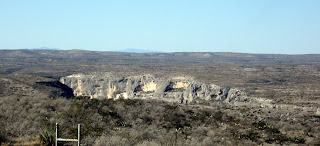
Stuart ready for his day in court, at thh Jersey Lilly.

Our most picturesque view from our Cottage...

Some local 'wildlife'..


Stuart ready for his day in court, at thh Jersey Lilly.

Our most picturesque view from our Cottage...

Some local 'wildlife'..

Laredo and Langtry
Pictures soon...
It’s 7am and the thermometer says it’s 20 degrees. There is nothing between me and the horizon to block the view of the warming. Even in these few seconds the color has changed, but the sun has not appeared yet, just the prelude. It can’t be more than 55 degrees inside our Cottage. This little traveling convenience is certainly not designed to be used in this kind of weather. It doesn’t take an open candle flame to tell you the wind is blowing through here as if it were a screened porch. We’re in Del Rio, TX. 7:11, and there’s the sun.
Brownsville looked, smelled and felt like a different place from here, and all the places we’ve passed getting here from there are different, too. The land is much more open, more cattle and junk cars. ‘Going to town’ means an hour’s drive from any ranch. I wonder about kids and getting to school; all these ranchers can’t possibly home school. Besides, I’m not sure if anyone actually lives on the ranches. About three times an hour I see a fancy entrance, with the name of the ranch shaped in the wrought iron arches overhead, always a Spanish title, gates firmly locked. There is no sign of a house, but it could be hidden behind the low-growing mesquite trees. We passed through Carrizo Springs, with a large pecan grove, a tiny town hall, some chained dogs and more junk cars, but I saw no people. I did see a small store/gas station, a couple of trucks parked outside, so there is life here.
This is serious Border Patrol territory, beginning at Boca Chica in Brownsville. We’re following the Rio Grande, but we can’t see it. There must be some law that says the highway has to be a certain distance from the border. There is a cattle fence on both sides of the highway, many days worth of fencing. This is not the Big Serious Fence we saw outside Brownsville, but a minor nuisance to people trying to cross. It might actually be a cattle fence. I saw a Border Patrol SUV driving beside the fence, dragging tractor tires chained together. Then, later I saw another, on the opposite side of the road, both driving along the cattle fence. Erasing foot prints? Shrub control? We’ve been stopped several times, but they haven’t asked for our passport. Guess with our accents, and dragging the Cottage, we’re not suspected of being illegal or hauling something illegal. One agent even laughed. Once. These folks are serious. I hope they were out in force last night, just in case The Illegals were out there. Anyone caught in last night’s temps would be dead without proper clothes.
There are many more old mobile homes now, and a few tarpaper shacks, but the surprise is a few white brick McMansions scattered in the hills. The McMansions are all on the border side of the road, set far back from the asphalt strip. There is no view, only a slight elevation now. The map shows just a few roads, mostly the black and gray ones, and the smallest town size symbols mark a few crossroads. Counties with names like Zavala, Maverick, Zapata that are half the size of a small state. Road rules are easy here: whatever you do is OK. A few big trucks are heading to this outback area, and they pass with ease, there is so little traffic. I’m watching; other drivers just drive on the shoulder of the road to allow faster movers to get by them more easily. The road surface is good, no disjointed bouncing like I-10 causes. Little taco stands appear anywhere there might be people around, some shuttered , and some looking like an oasis in the desert, with trucks pointed in to them from all directions. We have stopped at a few, to have a quick lunch. A carne asada taco stand will always make a good lunch, and if we are in luck, there will be caldo de res (beef soup), too. The tortillas are all good, and some are even made by hand.
There are two places to buy groceries in TX: WalMart and HEB. There is no other grocery store, even in the cities. The HEB owner is also the owner of the lighthouse at Port Aransas, infamous for keeping it completely private. The HEB is a big, nice store, with lots of produce, some of the citrus is local. I still haven’t seen the citrus orchards reputed to be in the RGV, they must be closer to the river.
There are International Bridges crossing the river at every little town. In Laredo, there are four: one for pedestrians only; one for pedestrian and car traffic; and two for commercial truck traffic. We paid $2 to park in a large gravel lot, and joined the crowds of retired Winter Texans, shopping bags in hand, to cross the border. It cost us a quarter apiece. We walked across the border in Progresso, to Nuevo Progresso, where there is one bridge for all the traffic. This is our third border town experience, and they are all very different from any town further south of the border. And, all three of the border towns have a vastly different personality from each other. Stuart and I agreed that in the Border Town Pleasantness ranking, Nogales is the most pleasant, Nuevo Progresso is nice, and Ciudad Juarez is a farfar third. Nogales is much larger than Nuevo Progresso, part of the ranking relates to the number of restaurants and tourist shops, and includes the cleanliness, feeling of safety and sleaze factor. Juarez is dirty, litter is everywhere. The restaurants are dark and filled with local drunks, the shopping (the reason most Americans go to a border town) is cramped hovels with high pressure men with gold-toothed smiles promising that this is the BEST price. Nuevo Progresso is very clean, no litter at all, the restaurants are small and pleasant with the kitchen right up front, there is some shopping here, and it’s small scale. The street vendors appear to be happy, not high pressuring passers-by to buy pirated dvds. The draw here is apparently dentists, they are probably half the tenants in the two block town.
Nuevo Progresso, for the tourists, is one street wide, and about two blocks long. The very first door inside the Mexico border is a dentist, and almost every other door in that first block is either a dentist or pharmacy. The young men outside are hard-selling cheap Viagra to all the RWT who are shopping with determination. We randomly select a dentist, and Stuart made an appointment for less than an hour later to have his teeth cleaned. $20. We spent the time on the street, being politely assaulted by pirated DVD sellers, silver jewelry salemen and various bag sellers. Typical street scene. After the dentist’s appointment, we strolled beyond the tourist blocks, where Stuart got a haircut ($3) and I had the most wonderful pedicure ($10). Some other RWT happened in, and I found myself in the surprising role of interpreter between the young pedicurist and the tourists from ND. The young women offered us a hot drink while I had my feet in the lovely warm bath. Avena, oatmeal drink. Delicious! Milk, cinnamon, a little sugar and oatmeal, cooked in a crockpot.
Afterwards, we had lunch of sopa de camarones (shrimp soup), and did a little shopping in a big store with lots of brightly painted pottery. I had hoped to find a clay comale, of the sort that is used in the central and southern parts of the country, but no luck. Too far away, and not popular goods. I looked down a side street, to see what the non-tourist section looked like, and it was a typical, poor Mexican town. The streets are not paved, the bicycle cart vendors are stacked beside each other, selling everything from tacos and elotes to oranges and garlic. The tiny old women, in ill-fitting shoes walk silently with their hand out, hoping for a few coins. In other parts of the country, I know the older indigenous people don’t speak Spanish, but the native language. I don’t know anything about the indigenous people here, don’t know what language they might speak. As we crossed the bridge back to the States, bodiless arms appeared through the tiny slits in the concrete rails of the bridge, on the Mexico side, hands out and voices begging for coins. On the Mexican side of the bridge, there is a screen completely blocking both the view and physical access, we can see neither the river bank or the people belonging to the begging hands.
There is such sharp contrast, just 100 yards apart. On the US side of the river, everything is paved and has the air of accomplishment, even if the thing is held together with duct tape and baling wire. A car or truck is a trophy, and is likely to have shiny, pricey rims on the tires, even if the rest of the vehicle is an assemblage of various vehicles. On the Mexican side of the river, there is a feeling of dust, desperation and watered-down shoe polish. The young women all wear shoes that make a noise when they walk, and wear ‘nice’ clothes. The young men are all clean and neat, hair combed back, no bagging britches in sight here. Someone is constantly sweeping the sidewalk, the inside of the open shops are dusty and a forgotten inventory of old shirts, broken brooms and plastic bags filled with who-knows-what.
In the States, you can be sure that the law will take care of you, in Mexico, you can be afraid that you don’t have enough money to pay the law to take care of you. Even a brief study of Mexican history, post-Columbian, will show that bribery is how the government has been run for many generations. Don’t know about now, but there is so much desperation to come across that river, I have to wonder. The Wall here is a hotly discussed topic. I’ll just say that it makes little sense to me to spend millions of dollars to keep people from coming here. There are other ways to help our fellow humans have enough food to eat.
Did I tell about our visit to the Resaca de Palma State Park? It’s on Carmen road, on the northwest of Brownsville. Our directions told us to turn on Carmen Road, but what we thought was Carmen road was a very badly rutted dirt road through a field. We passed it twice before driving down it, and sure enough, we ended up at the State Park. We’d come in by the back way. It was a cold day, but we put on our wool hats and gloves and headed out to see some birds. It’s a new park, only two year old, and we were instructed to hop on the open-air wagon towed by a park truck, and were driven to the trail of our choice. We spied several different water birds, and had a nice walk through the Texas Ebony forest before being picked up by the trolley. Our driver stopped a couple of times to point out things of interest: the wild pigs tearing up the roadside and the beetles that chew off limbs of a specific tree in their mating frenzy. Afterwards, chilled thoroughly, we had lunch at Kiki’s Parillada, with enough Mexican barbeque to take home for dinner. Good tortillas, too.
Another day on the road, we spent the night in Laredo, at a pretty state park on Lago Blanco, White Lake. It’s windy and cold, there was a pretty sunset over the lake. The thermometer read 28 degrees at 8am.
We saddled up, headed west, driving through the Rio Grande Valley, or The Valley. We still see nothing of the citrus groves I’d read about, they must be away from the highway. From here, the terrain changed almost imperceptibly, from dense population and heavy Spanish-speaking influence, to ranches with Spanish names, to ranches with no names and no signs of people at all. We spent a veryvery cold night in Del Rio, on the river. Stuart brought our water hose inside. There are no trees here in the high desert to break the wind. For a while we didn’t have any hot water, the wind was strong enough to blow just enough gas into the Cottage to cause the alarm to go off. Today, we drove across the Pecos River, a major tributary of the Rio Grande, and through gently rolling hills of brush and not much else. This is the definition of ‘you can see forever’. From a slight ridge, you can see the same brush and rocks, well, forever in every direction. This is cattle country, and we see a few cattle in the brush. What do they eat, in this dry, rocky country? The ridges got higher, and soon we are in canyon territory, and the view gets more dramatic.
This territory is famous in recent history for being the joining point of the Union Pacific railroad in 1882, connecting New Orleans with California. If you remember your American history, you’ll also remember this is the place of total lawlessness, forced Chinese labor and Judge Roy Bean. Yep, we find ourselves in Langtry, TX, at the Jersey Lilley (sic) saloon and courtroom. The original buildings are lovingly restored and displayed by the TX highway department, free admission. The saloon is much smaller than I imagined it would be. You know, he never met Miss Lily. She finally visited the town about 10 months after the good Judge died. The population of the town is now 29, and if you look carefully in the desert, you can see some stone foundations of the canvas houses from more 150 years ago. Langtry was a railroad sponsored town, and Judge Bean was not really a judge, but he managed to create order. This final section of the railroad was a feat to be admired, this is tough geography for a train to negotiate. The more than 300 foot drop from the top of the cliff to the Pecos River required the tracks to take a circuitous route to cross. The train is still an important mode of transportation, and one that makes far more sense than trucking. Yesterday, we counted 82 cars, containers stacked two high on the cars, just on one train.
Lunch in Sanderson, infamous for being the ‘town too mean for Bean’. This almost-ghost town, population 861, goes down in the history books with the story of the saloon keeper who poisoned Roy Bean’s whiskey barrels with kerosene when he tried to set up shop there. The bank was also robbed by the Wild Bunch, and we saw the photo of the unlucky bandits responsible for the Last Great Train Robbery in the West. In the photo, the dead bandits were being held upright by the men who shot them, sort of trophyish. Sanderson is also the Cactus Capital of Texas. Hey, hold on anyway you can.
We spent the night in Marathon, population 455, one of two who found our way to this tiny crossroads. Marathon is one of the two crossroads that can take you to the Big Bend National Park. This is beautiful country, in a stark, dry way. The mountain ridges are on three sides, and there is nothing between us and them. The train track runs right beside our campsight, but a town could have never been born out here if it were not for the railroad. The sunset gave us nice colors on the hillsides to the east and the temps fall dramatically after dark. The previous night low was 8 degrees, and the little fountain by the office was still frozen at 3pm, when we arrived.
My sinus irritation is showing signs of improving, today I can get a little more air. Stuart’s has moved to a cough, but not too bad. We’re staying put today, my goal is to stretch, write a few postcards and maybe take a walk in the desert. If the temps get a little warmer.
Friday, January 8, 2010
Port Arthur to Rockport, TX
We approached TX from the north side of Port Arthur, slipping into the state between Galveston Bay and Houston. We try to avoid these slice-ways of asphalt, these 6-lane strips of high tension and fast driving. Dragging a travel trailer is not fun in this kind of traffic. But, in order to hug the coast, we must punch our way through this congestion. It’s grey and raining. Again. The landscape is even more dreary with the aftermath of Hurricane Ike. At lunch, our waitress in a little Italian restaurant told us she is still waiting for her apartment complex to be rebuilt, hoping to move home in 60 days. We feel her pain. After 18 months, there is still much work to be done before many folks can move home.
One night we stopped in Bay City, TX, at the town campground and golf course. It was 15 miles from town, but in TX terms, that’s practically in the center of town. The little
park was quiet, even spooky because there are signs of life, but we see no people at all. We drove in, found a note on the door telling us to pick a campsite and they’d catch us later. We set up in the shallowest puddle of a campsight we could find, in the drizzling rain, and went for a walk to work off the road jitters. The Christmas light show was still set up in the park, but there would be no lookers now that the frenzy was over and all the gift wrap is on it’s way to the landfill. And, to tell the truth, after having seen both James Island, SC and Bellingrath Gardens in Mobile, this was a little pathetic. But, their spirit was evident! The only life we saw in that park was the 12 deer grazing, and two trees hosting turkey buzzards bedding down for the night. The next morning, we pulled out, leaving some money stuffed in the door of the office, still having seen no humans. There is a photo of the buzzards in the trees in the last post...
The geography is getting firmer, the farther we get from the bayous. Even this close to Cajun country, the restaurants are completely different, as if they are ignoring their food cousins less than a two hour drive to the east. Now, we’re in cow country. Today, we began to see the land flatten and dry out, changing dramatically from watery, boggy fields of crawfish, rice and cane, to grassy prairies and plowed fields that go all the way to the horizon. When I would ask daddy how he could set a row in the field so perfectly straight, he always answered me with a smile. I guess I’ll never know how they do it. There is water here, but from the three weeks of rain, and the ditches are full.
We landed in Rockport, TX in the mid-afternoon, the sun a welcome stranger hitchhiking with us. You can’t swing a cat without hitting a RV park here! We passed at least a dozen in a couple of miles. There are signs everywhere, welcoming the Winter Texans. Always capitalized. So many retirees, wintering here from Minnesota, Michigan and Iowa. So, here we are, in the Capitol of the Snow Birds, on the edge of some of the best birding in the country. Our semi-destination for this trip!
Our campground is The Ancient Oaks campground, less than a mile from the beach. It’s mired ankle deep in mud, and the old folks are gently picking their way between the low spots. While waiting for Stuart to sign in, I saw a man walking very slowly with two canes. He eventually made his way to his motor home and drove away. Hope he can move more easily from accelerator to brake than he can move while walking. Our host led us through the trees, between campers greased into their spaces between each other, to our spot in the open air. He plunged his hand halfway to his elbow to find the sewer cap, and drained some water from the site. I maneuvered our camper as best I could, next to the 5th wheel to our right. Let’s hope they don’t have some contagious disease, we’re so close we would surely catch what they have. Eleven minutes later, we’re camping!
When we bought our first travel trailer, the one we eventually called the Sunbeam because it resembled a little round Sunbeam toaster (and was not much larger!), we spent the first and second nights in Minnesota. The second night, being the Very Proud Owners of our little home on wheels, we were enjoying a cocktail beside our shiny new home (warm, no rain), hoping someone would recognize that we had something new and fabulous. An older man pulled his big-ass motor home into the space beside us, and we watched as he put the behemoth in park. Then, we heard a faint whirring, and watched the levelers drop down close to the front and back corners. A slight adjustment, whirr-whirr, then the tv antennae rose from the roof like a Phoenix, whirr-whirr. A few more minutes of the diesel motor running, and he turned off the motor. The steps whirred their way into position, and the man exited the bus. He walked around to the opposite side, and in a minute or two came around and went back inside. We’re watching all this with no signs of shyness, from our chairs beside our suddenly tiny little home. In a minute, he came back out, fancy folding chair in one hand, drink in the other. With a snap of his wrist, the chair became a chair, he smiled at us and called out, “NOW I’m camping!”
All this took about eleven minutes. We have laughed at this scene since! Camping, with satellite tv, auto-levelers and air-conditioning! I have to tell you, though, we don’t have any mechanical conveniences. But, we do have a system: I back it into place, Stuart puts the leveling boards down with great efficiency. He begins to unhook one side of the leveling bars, I unhook the other. He finishes the unhooking while I plug in the power cord, and the water hose. Then, he’s finished unhooking, and I pull the truck forward, and he levels it front to back. In eleven minutes, we’re camping! If we pull out the awning, it takes both of us, but we don’t pull it out if we’re moving the next day, or if it’s windy. But, that’s another story, for another day.
Here in The Ancient Oaks Campground, there is surely no room for our awning to come down, no matter how long we’re staying. I scanned the newsletter, with the list of events for December, and saw that the Ancient Winter Texans are busy, indeed. Weekly bingo, a Christmas Decoration Contest and a pool tournament are all on the schedule. These folks are busy!
We went into the little harbor, downtown, and toured the very fine Maritime Museum. They have every right to be proud of this. Here, we saw exhibits telling the story of a ship raised from the water after 100 years; learned about the cattle and cattle by-product shipping and the history of Rockport; the shipbuilding industry that supported both the war and the town; and toured the oil industry wing funded with pride by Ken Lay. I learned much about those spindly-looking towers we’ve seen for the past couple of weeks, and more about how the oil is captured and brought to shore.
Stuart loves to look at new travel trailers and dream of the Big One we can neither afford to buy or to pull, so we had to go to the RV lot we’d passed on our way into town, to see the new travel trailers for sale. We spent the rest of the sunny afternoon on the sales lot, Ronnie told us much about the new models. Our little Cottage is 10 years old (thanks, Hurricane Floyd), and not worth much on a trade-in. Of course, we saw a couple we could live in, but thanked him for his time and left without owing any money. Stuart is a happy boy, a fist-full of brochures to dream over. The equivalent of the Sears catalog for a kid at Christmas.
That night, we had dinner at Los Comales, a crowded, noisy restaurant recommended by Ronnie at the RV sales lot. We met a nice local couple, who told us that trying to go to the Aransas Wildlife Refuge was a waste of time. See, there is a full moon now (really beautiful!), and the animals are all feeding at night. When I told them I wanted to see the birds, they said we’d love the place, even though I could tell they didn’t really understand. We laughed together at their clothes for the night: both had on wide striped shirts. I thought they might be jailbirds, which made them laugh even more.
We are close to Padre Island, part of the necklace of islands along the TX coast that hosts enormous bird populations. The day we drove out there began with heavy fog. We stopped to see, through the binoculars, the lighthouse off the coast. It is now owned by the man who owns the huge TX grocery store chain, HEB. He bought it in the 1980’s, renovated both the keepers house and the lighthouse, and now has a full-time care-taker living there. Tours by invitation only, I remind you! We caught the free ferry across the Aransa Pass, and the eleven minute crossing entertainment was provided by about a dozen dolphins fishing for lunch in front of the ferry. Having the front row parking spot was perfect. At Port Aransas, we drove south. This little island is about the width of Wrightsville Island, and probably shorter. Another man-made causeway connects Port A with north Padre Island and Mustang Island State Park. We drove through, turning right and on to Corpus Christi, and back to the Ancient Campground for lunch. By now, the fog had burned off, and it was a beautiful day. Stuart decided to do the laundry, and I took my bike out for a tour of the town.
We’re on the main road, TX 35, which is pretty busy, so I turned off it as soon as possible, and zig-zagged my way to the coast road. There, I pedaled as far south as the road went, past the summer cottages mostly boarded for winter. Then, back-tracking, I pedaled through the little town, walking my bike along the 2 blocks of businesses, window-shopping the little art galleries. In the little town, I found a little birding sanctuary, one that was begun by Mary….in the 1930’s. She was really the start of the eco-tourism business here. The little motor court where she and her husband lived and worked was memorialized with a small park now. Mostly underwater today because of the recent rains, but well preserved in her honor. I pedaled through the little town, and to the end of the public beach. What a nice spot, a little spit of land between the barrier islands and the Copano Bay. A couple of hours later, I returned home, to find Stuart and a load of clean laundry. We cooked a steak on our tiny grill for dinner, all the while swatting the biggest mosquitoes I’ve ever seen. Whooo, they grow ‘em big here!
Aransas National Wildlife Refuge is just north of Rockport, and covers the entire peninsula between Matagorda Island and northern Copana Bay. It’s one of the biggest wildlife refuges in the country, and home of a wonderfully diverse winter bird population. Snow birds in the real sense of the word. ANWR is particularly proud of the migratory whooping crane population that call this place their winter home. There are about 450 whooping cranes in the entire world, and more than 240 of them winter here. I hope to see at least one today! It’s a cold, clear day. I have a wool hat, gloves, heavy coat with lots of pockets, and a good pair of binoculars. And, a picnic lunch on the seat beside me. With a map provided by the visitor center, I hit the first trail. Two hours later, I emerged from the half-mile long trail, dazed and happy. What things I have seen! The biggest ‘gator I’ve ever seen: this dude is about the size of our trailer. Lots of ducks, both dabblers and divers and a flock of roseate spoonbills. And, lots of white pelicans. Now, we have brown pelicans on our lovely coast, but I’ve never seen white pelicans. They are larger in both size and numbers than our endangered brown pelicans, and vocal. I also saw my first kiskadee, id’d by a woman from Corpus Christi, and I saw lots of egrets and cranes. Oh, and a few armadillos up close. After a short, late lunch break, I walked the oak trail, and climbed the steps to the observation tower at the south end of the preserve. There, after a while, I saw the pair of whooping cranes in the marsh. They were graceful and big, wading through the shallow water, eating and looking around. They shared the scene with some deer, behind them in the marsh, and lots of white pelicans. The daylight was dwindling, so I headed home, chilled but happy with the sights of the day. This was a highlight of the trip for me.
We’re on the road again, driving through enormous ranches and not much else. There is a huge ranch here, the King Ranch (no relationship, unfortunately), that is not measured in acres, but in Rhode Islands. Three of them, to be exact. It has it’s own post office and zip code. According to AAA, the population of Kingsville is 290 people, none of whom are visible. Folks sure like their privacy here. How a cow lives on this dry land is beyond me. We don’t even see many cattle, but see the fences and the local feed/seed stores every hour or so. Wait, there is a herd now…they have very long horns, sweeping straight towards their tails. And, a few of the long-horns, with their horns growing impossibly far to each side of their heads.
The signs we see are increasingly in Spanish, and English is disappearing. The radio stations are also mostly Spanish. By the time we get to Brownsville, TX, English has almost disappeared. No one has asked for my passport yet, but I feel like there will be a border agent in my face any minute, asking for ID. Our campground is on the southwest side of town, Breezelake Campground. I learned that the Winter Texans have been coming here for more than 25 years. In a few casual conversations with some of the local ‘citizens’, it’s obvious they don’t have much use for anyone who doesn’t speak the way they do. And, the suggestion of crossing the border brings looks of distrust and comtempt. But, the schedule of events in the campground excuses them from any outside contact: bingo, pool tournaments and ‘the girls with their beads’ meet daily, keeping everyone busy and connected. And, there’s the activity of watching for new arrivals, too. We’re gated in, so there is no danger of crime here in the mobile home park.
This area has been under 7 flags since Europeans began invading. It’s no wonder there is confusion as to their nationality. But, Brownsville, TX is one of the busiest international ports in the country. The Valley, as this lower Rio Grande River Valley is called, offers much for big ships, and to the large plants that have sprung up in northern Mexico in the past few years. Brownsville’s population is about 150,000 people, and they ALL drive a pick-up truck or huge SUV. No gas worries here.
We drove down to Port Isabel, to see the lighthouse. This is the only lighthouse in TX open to the public. We climbed to the top, and admired the view of the South Bay and Gulf. This lighthouse guides ships to the Port of Brownsville, which is not on the Rio Grande River, but in the bay. Afterwards, we drove across the bridge to South Padre Island, and admired the McMansions before heading back to the mainland, and some lunch. It’s cold and cloudy, but there is no rain.
Moving towards TX
Pour yourself a beer or glass of wine, or maybe just set the cooler close by. This is a long post.
We have been moving as if our pants are on fire for the past few days. The last time I wrote, we were just leaving Cajun Country…we stayed in Broussard, just south of Lafayette, LA for a couple of days. The colors of the bayous and fields are pretty and the attitude of the Cajuns hint at a very pleasant, easy-going life. We walked through a cemetery in Broussard, by the Catholic church (of course). Names that sound foreign to a southern girl, andI’m sure I mispronounced them all. Many Hebert’s. I wish I had written down a few, just because. The names of the people and the history of the place remind me, again, that we are a country of immigrants. Many of us never stray, once we find the place called home. We never did buy any boudin, but we’d had it before. Essentially sausage with rice, stuffed into a casing. A local taste treat, family-owned meat markets proudly advertised it in big hand-written letters on neon poster board signs in their windows.
From Broussard, we drove west to one of our favorite small LA towns: Maurice. Home of Hebert’s Meats. When we walked in, three middle-aged women laughed, one of them grabbing me by the arm. “I KNEW y’all were coming here!” They had followed our annoying travel trailer, on the country roads, all the way from Broussard. And, she really did say ‘y’all’. We filled our freezer with some of Hebert’s famously delicious stuffed chickens, picked up some etoufee for dinner, and headed towards Lake Charles.
We are so close to the Gulf I think I can smell the salt air. You can certainly see the impact the oil industry has on the local economy. For days now we’ve seen all the support businesses for the oil industry. We’ve seen the oil rigs out in the Gulf, and the oil refineries from the moment we hit the Gulf in Mobile, AL. We’ve seen the parking lots for the off-shore workers, with airports, helicopter landing pads or shuttle bus garages by them. And, with this driving trip, Stuart and I are doing our best to keep all these people in business!
We passed through Lake Charles, an industrial-looking city, and unhooked our Cottage in a parking-lot-looking campground outside the town of Sulphur. We’ll be here less than 18 hours. Sulphur is a more industrial looking place than Lake Charles, if possible. The Sabine National Wildlife Refuge is south of here, which is named for its western border river. Seems incongruous; all the heavy, ugly industry and the thousands of acres of calm, quiet marshland preserve. We drove past a huge complex of smoke-belching, pipe-mazes, oil refineries, on our way to the SNWR. I think the smoke was steam…
There isn’t much stirring in the middle of the day, and today there is a strong wind which doesn’t help birding, either. It’s cold, and we put on hats and gloves to walk the grass trail, looking for birds. My bird book is safe at home, we’re handicapped in the ID department. But, it is a sunny day, we had a nice walk, and we did see some water birds. On the way home, we detoured a few more miles south, through the marsh to Holly Beach, home to about 6 travel trailers and a few skeletons of stick-built houses. In some ways, it reminds me of Topsail Beach, from years ago. Hurricane Ike, 2007, hit this little barrier island beach hard, and the recovery is slow. The road is a causeway that runs for more than 20 miles, connects the firm land to the island. If I’m in this area again, I’ll continue east from Holly Beach along the coast, cross over the Cameron river on a two car ferry, and up the east side of Cameron Lake, to make a circle tour of the area. Even better, I’ll do it on my bike! But for today, the sun is almost gone and we drive back to the Cottage.
Public radio has kept us informed and entertained. It’s the first thing I do when we get to a new campground and get plugged in: look for the local radio station. We don’t have tv (our choice, every private campground offers all the stations), making All Things Considered even more important every evening. We listen while we have a drink and popcorn, our normal evening routine. Later, many stations run local music programming, or some of our favorite national shows (Performance Today, Fresh Air, etc). This week, between Christmas and New Year’s, Fresh Air has been a repeat of some of her best interviews of the year. Tonight, we listened to an interview with Woody Allen.
The weather has been cold and rainy for three weeks, but the past 48 hours have been blissfully sunny. Cold, but sunny. I shouldn’t whine, when I think of my friends in NC, MD, VA and WV, some of whom are getting lots of snow and ice. Some places are ordered to have snow and cold this time of year…I just got a note from a friend in London, with the snowy street scene I expect from him this time of year. But on the Gulf Coast, it’s somehow just Wrong to be this cold for this long!


Subscribe to:
Posts (Atom)