Saturday, July 27, 2013

Fortress Louisbourg

I've been dashing off a few notes about this long-awaited trip to the Canadian Maritimes without much thought about organization or writing.  Reading the last few posts about this trip proves that dashing is not good!  From here on, I promise myself to take a little more time with the notes and photos.  Now that we're back home, I'm working from my hand-written notes.

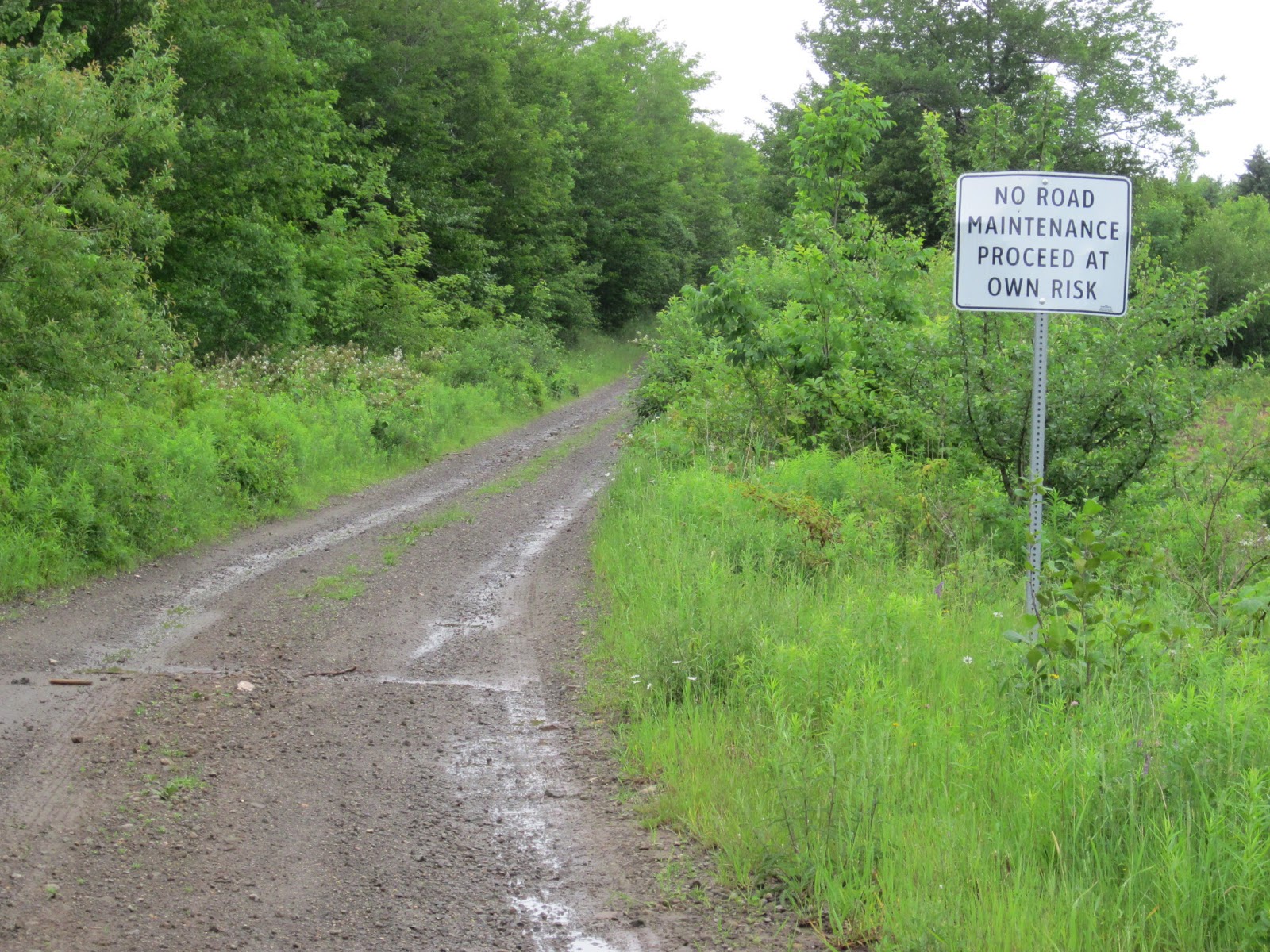
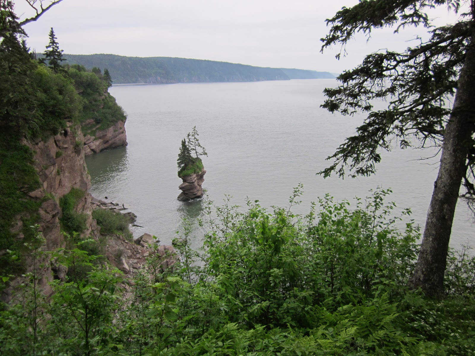
Cape Breton Islands.  I know, it's proper name is Cape Breton Island, but if you look at the map, it's really several islands.  Bras d'Or Lake is really several lakes.  I was reminded of the Seattle area:  no matter which direction you head, you're gonna run into water!  Before we went to CBI, someone told us that pace there is much slower.  And, it is.  Part of the reason is there is so much beautiful scenery to look at.  Forests, lakes, rocky bluffs and wildflowers covering a good portion of dirt that is not farmland.  Another reason is the roads are in awful condition, because of the freezing weather.  We parked the Cottage at MacLeod's, which made the driving a little easier. 

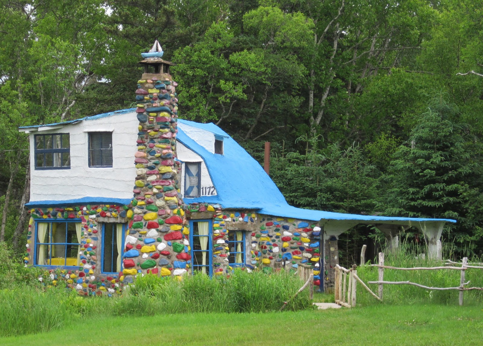
There are art galleries and craft shops everywhere, little secret places in someone's house or barn.  Farms of hay, and some cattle.  But, mostly the income here is from fishing and tourism.  Tourism businesses must make it in about 2.5 months, making the summer months pretty intense for seasonal workers and businesses.  High Season begins the last half of July!  "If summer falls on a weekend, let's have a picnic!" is the rule. 

One day, we drove west to east, and found a 5-minute ferry across a sandspit.   The Englishtown Ferry.


NS is rightfully very proud of Fortress Louisbourg, on the far eastern edge of CBI.  The French built it, and for about 50 years operated a busy port shipping fish and wood from here.  The English won, however, and the fortress was finally abandoned in 1768.  I guess if things had gone differently, I'd be speaking French!  It was a troublesome time for the New England/Martimes area.  The fortress was a huge, make-work project, sort of like the CCC projects in the US during the Great Depression.  Here, the coal mines had been the major employer, and when they were closed in the late 1960's, the government dreamed up the idea of restoring part of the Fortress, and creating jobs by doing so.  Teams of archeologists and scientists of all kinds spent several years digging, learning and researching.  The miners were re-trained in blacksmithing, log-building and all the peripheral jobs required in this huge project.  Everything about the Fortress is authentic to the period, right down to the hand-made nails and door hinges.  Costumed historians live the personality of various people who would have lived there, and it was presented with great planning and execution.  We bought a small loaf of bread, baked that morning in the wood-fired ovens in the same way it would have been baked for the soldiers living there in 1750. We watched a group of soldiers fire their authentic reproduction weapons.  One soldier tried three times before his fired.  I think we talked to every interpreter there, and they all had great stories to tell.  I learned more about the history of the New World than I ever learned in grade-school!  We watched a demonstration of High Class dancing...the rich folks doing what would become what we call square dancing..  The harpsichord was beautiful, and I was allowed to touch the keys. An entire day was not enough, but when we got on the bus back to the parking lot, discovered how tired we were from a day of watching history.
Roof-tops, built with hand-made cedar shakes, hand-cut lumber, hand-made windows.


Young soldiers, "piping in" the artillery regiment...


The artillery regiment.  I noticed they were all wearing ear protection!  The only modern accessory I saw all day.


This maid and her daughter graciously allowed me to take their photo.  We are surely in a French fortress!  The little girl didn't speak english.  English was the second language for the mother.
Even their shoes were hand-made, in 1750's style.


I found the ice-house interesting.  Yes, ICE in 1750!  Inside this cone-shaped building is a deep well, lined with stones.  The Governor of Louisbourg did not allow the door to be opened until after dark in the summer, to keep the cool air inside.


The Engineer for the settlement lived in the second largest house, after the Governor, of course.  He was also the second more important person.  In his study, we saw plans on the table for the hospital, which has not been reconstructed.  But, we know from detailed records it had 100 beds, room for the nuns and nurses, and a big kitchen.  The Engineer's garden was pretty, and being a well-to-do man, didn't have to be completely devoted to food production. All those purple flowers are chives.
It was a great day.  Afterwards, we drove around to the opposite side of the cove, to see the lighthouses, and look for lobsters.  But, that's another story!

Thursday, July 25, 2013

Cape Breton Island(s)

Pulling out of the cg in Halifax was not at all difficult.  The cg was quiet, clean and convenient; but, it was not a place to which I'd return given other options.  Maybe I was ready to move on; maybe it was the friendliness of all the other cgs we'd been in compared to the non-personality of the folks here.  No matter, we're on the road!  We drove north on a good road, then turned east, on another good road.  It's not such a great distance, but I don't like to drive more than about 4 hours in one day.  Call me Princess.  We stopped mid-afternoon in Antigonish, pop. 1,800, at a cg right in town.  Early enough for a bike ride, which always works out the kinks.  While I took a tour of the campus and downtown area, Stuart walked through the pretty little downtown, picked out a restaurant for dinner.  Danged good thing:  we haven't eaten a good meal out yet.  Points for Stuart.  Gabrieau's, was recommended by the Good Restaurant Guide book we picked up when we came into NS.  But, he didn't know it was in the book!  I had a lovely, locally grown beet salad, before the locally caught salmon with the locally made maple syrup glaze.  We ate outside, it was a nice night.

Next morning, we drove east, to the Canso Causeway, linking lower NS to Cape Breton Islands.  The deepest man-made causeway in the world.   Eight hundred feet wide at the botton, 300 feet deep.  We headed north on the west coast road, NS 19, to Judique, where we stopped for lunch at the levelest part of the island.  The Little Judique Train ran through here in the early 1900's, making up for lost time on the hilly, curvy sections north of here.  Being on the Island feels different, and there is not really any good reason except that the views are dramatic and the pace is slower.  The pace is something we can't possibly know about, having just arrived, but we could feel it.  Not having a reservation, arriving on a weekend, we were danged lucky to get a spot at MacLeod's Campground and Beach.


 As we turned off the terribly-paved road onto a gravel road, we wondered what we were getting into...but, as we turned off the gravel road into the cg, and saw the freshly-cut hay field and the cg overlooking  the Northumberland Strait.  This photo was taken from a few steps from our campsite, at sunset.  The small sandy beach was tucked in between rock cliffs, with lots of small colorful rocks for collecting.  We stayed here several days, and toured the Cabot Trail from here. 


Northern Cape Breton Island is mostly set aside as National Park, and what a jewel for NS!  Beautiful vistas around every turn of the road.  The Scottish settled here, in large numbers, between 1790 and 1830.  After the French were conquered by England and New England.  The road signs are all in English and Gaelic, and the names on roads are all Scottish-sounding. Fishing, and a little farming, are the main livelihoods. 


Our pretty beach, late in the afternoon.  The water was too cold for me to swim, but a few hardy children were splashing and squealing in the heat of the afternoon.  I loved walking, picking up pretty, colored rocks.  No clue what I will do with them!

Sunday morning, while it was still cool, I pedaled the loop road, from our cg, around the cove and up the coast, back to the paved road, then back onto the gravel loop road.  The wild roses were everywhere!  Nice ride, uphill the whole time.  Not.


Sunday afternoon, we drove back up to Cheticamp, about 45 minutes north, and jumped on the Whale Cruiser for a couple of hours.  Our host, who had been out that morning, told us it was one of the best tours he'd been on in several years.  They saw LOTS of pilot whales.  Well, just a few minutes after we pulled away from the dock, he was even happier:  We saw several dozen whales, and they played and swam around our boat for over an hour!


MacCleod's Beach and CG was one of the pretties places we stayed...I hated to leave, but, we're heading now to the eastern part of the Island, to historic Fortress Louisbourg.


Thursday, July 11, 2013

Halifax, by the Sea

The drive to Halifax from Kentville is less than 2 hours, on very good roads, thankfully!  We checked into the Woodhaven RV Park, just north of Halifax.  Jammed full of huge rigs!  We were assigned a site that was about 2 feet too short for our tiny Cottage, but we managed to shove the Cottage in.  Rainy and cool.  At the office, our hosts told us about the International Royal Tattoo being held this week in Halifax.  What a chance!  We gathered the maps and drove into The Big City to buy tickets.  After having been in tiny villages and in out of the way places off the tourist track for a month, this was a little bit of a shock.  Our truck is too tall, with the kayak racks on top, to get into a parking garages (note to self:  remove the danged things when not hauling kayaks!), so we circle looking for on-street parking.  Tickets are available for tomorrow night, pretty good seats, $80 for the pair.  Yippppeee!

One of the museums on our list for Halifax is the Immigration Museum, on pier 21.  Sort of the Ellis Island of Canada.  Our tour guide, Charles, is an older man who arrived from Amsterdam through this sorting facility in 1951.  What a great guide he was, with great exhibits!  Lots of photographs, faces and ships and lists of places.  Nova Scotia, New Scotland in english, also attracted lots of Italians and eastern Europeans.  Afterwards, we found Garrison Brewery on pier 20, bought a couple of bottles, and lined up in the rush-hour traffic getting out of the city. Surprise:  lobster for dinner! 

Peggy's Cove is a famously pretty lighthouse and fishing village not far from , and we prepare lunch of lobster salad and crackers for the day trip.  There is some sun!  The drive down to Peggy's Cove follows along the west side of a wide penninsula, lined with small fishing villages and summer houses.

At Peggy's Cove, the landscape changed dramatically to low granite rocks, with a few scrubby-looking trees trying to live in the rocks.  This village has been here for 300 years, houses built right on the granite.  Lobstering, tuna and mackeral fishing kept a dozen families here.  The fishing is not so good anymore, like most places, and with the famous lighthouse, it has become a tourist destination.  With good cause:  it's one of the most  picturesque places around!


While we climbed on the rocks, a bagpiper stood near by, piping for the tourists.  It was really nice. 

Inside the Village of Peggy's Cove, which is really a collection of a couple of dozen scattered houses, we found the studio of William deGarthe.  He lived here most of his life, and began at age 70 this carving in the huge granite rock in his yard.  It's 100 feet long, and depicts 32 fishermen, their wives and children, all being hugged by the wings of St. Elmo, the patron saint of fishermen, and the woman credited as the namesake of the cove, Peggy.

Picnic of lobster salad on the shore of the Bay, and back to Halifax just in time to change clothes and drive into the city for the Tattoo!  Looking, again, for parking, we found a tourist booth for Cape Breton Island.  Lucky us, she gave us lots of good info and maps for the Cabot Trail.  Having exchanged a lot of money for a parking place, we found a pub for a quick pint and snack before the show. 


Inside the arena, we found our seats in the center, second tier up.  Perfect!  The show was as terrific as advertised, more than worth the price.  Teams of military musicians performed in fabulous costumes, lot of marching and dancers in kilts and plaid socks.  The trick motorcycle team from Hamburg Germany performed; a rogue Scottish fiddling band had the crowd clapping dancing in our seats; a ukelele band from NS had us laughing and cheering;


and a corps of fine-looking soldiers from the Citadel, Charleston, SC did The States proud.


A great day, full of adventure!  Tomorrow, we hear the sky will be CLEAR, and we'll begin the drive up to Cape Breton Islands.  I'm sure there is more in Halifax to see, but 2 days of Big City is enough for now.

Wednesday, July 10, 2013

Canada Day in Kentville, NS

Canada Day, sort of like the 4th of July in the USA, is  this coming weekend.  The Big Birthday Party for the country.  And, it's a long weekend.  So far, we've pulled into campgrounds with no worries of finding a spot.  But, we're smart enough to know this weekend, the Official Beginning of Summer, might make finding a spot more difficult.  True that!  After calling 8 campgrounds in the Annapolis Valley and finding no room at any inn, we were relieved to hear Marvin, at Highbury Gardens in Kentville say he'd find a spot for us.  After our conversation, I scurried to the map to find Kentville.  Looks like it's in the middle of the Annapolis Valley, putting us in the middle of where we wanted to be.  Perfect landing, as always!  Tomorrow will be a long drive (for us):  about 6 hours in one day.

At the Province visitor center, we collected a stack of literature, including a very good map, a list of farmer's markets, a brochure outlining the very best restaurants in the Province, and a list of art galleries.  Well armed, we drove to Kentville on very good roads, and found ourselves in a small commercial hub for the Valley, on a narrow road congested with tourists and locals.  Our host at the cg surprised us with the news he'd found a space with full hook-ups, knowing we'd be here a full week.  Sure makes our life more pleasant, even though our purse is lighter!  We settled in the quiet cg, knowing in a few days it would be jammed full.  Here are a few photos of what we saw for the next few days, in spite of the rain:


Lunch at the brew pub on the Cornwallis River in Wolfville, on a perfectly rainy afternoon.  Poutine is a local favorite.  Hand-made fries, in a delicious gravy, with lobster and local cheese curds on top.  Oh my!  This is an Acadian population, the remains of the original Acadians who were rounded up and shipped out by the British in 1755.  Sad history.


The rain stayed. It has rained almost every day for 3 weeks, including the week of Canada Day.  Those poor folks who had a glorious three day weekend away from work were soggy, but unbowed.   This is the view from our outside table at the restaurant, where we were the  only people to sit outside.  Under a nice canopy.  By now, I was beginning to feel a little depressed by all the gray.


We visited the National Museum dedicated to telling the story of the removal of the Acadians from Nova Scotia.  ohmy.  After having read about the Cajuns in L'siana, and having been to St. Martins, in the Bayou and seeing the statue of Evangeline, we are arenow at the point of expulsion, the beginning of the story. The British and French turf war involved these peaceful people, in a way hard to understand today.  The museum here is terrific, which included exhibits of wooden gates the Acadians used to drain the wetlands here to create awesome farms; a film that will bring tears to the eyes of anyone, and a view of miles of dykelands created by the Acadians before they were shipped out in 1755.  Highly recommended visit for anyone within 100 miles of this beautiful place.  The photo at left here, is the church built in the early 1900's, dedicated to the Acadians, and the statue of Evangeline, the fictional woman immortalized by Longfellow.


Another rainy day.  Hall's Harbor has a lighthouse, and is on the pretty Bay of Fundy, the North Coast of NS.  We drove up there, and found this tiny fishing harbor that is trying to survive with a little lobstering, and a little touristing.  It is surely pretty!

We arrived in the morning, at low tide, and the boats were on the hard.  The lobster boats were apparently out, these few pleasure boats were not going anywhere for another 6 hours.  Not far from Hall's Harbor, at Black Rock, just about 10 miles south of here is another lighthouse.  Our map shows several roads from Hall's Harbor, and we find ourselves on this one:
Yep, there was surely no maintenance.  And, there had been a heavy rain last night.  Well, I can back out of anywhere....we made it, much to the surprise of some locals later that day who heard our story.  No four-wheel drive on this truck, either!

When we arrived at Black Rock, we found this delightful house, just a few houses back from the shore.
In 1929, Charles William MacDonald began building 5 houses from concrete and local rocks.  He was a local man, who believed in the power of concrete.  Check out the website dedicated to his work, to read more about him and these funky little houses.  Four of them survive.  http://www.concretehouse.ca/uncommon/BlueCottage.pdf

We continued on to Black Rock, and found this lighthouse:  Built on a rocky ledge, it is still lighted.

One sign we've seen often indicated rough road ahead.  The road people don't use enough of them, imho!  But, we came around a corner down a hill to the coast, and found one that had been edited, indicating a sea dragon ahead!  Picture later, it's on the other camera (and I neglected to bring the card reader with me!).  I think this is called a "teaser".

Canada Day the skies poured rain.  All the local celebrations were either held in the downpour, or cancelled.  We watched people in our cg try to dodge the rain, and play games outside on this first weekend of summer, holding their beers under a raincoat or umbrella.  The next day, still raining, we drove to Port  Royal, at the head of the Annapolis Valley, to see the Habitation.  It was a small fort built by the French in 1605.  Short-lived, it was the first settlement by Europeans in the area.  The British destroyed it in 1613.  For that time, it was the Capitol of Acadia in the New World.  The remarkable restoration of the fort was worth the drive, and a tour in the rain.

The Annapolis Valley is beautiful farm land, and we have bought local peas, potatoes, carrots, cheese and greens. There is a farm market in every little village at least once a week, and local stands by every little farm, with hand-painted signs offering strawberries or peas or eggs.  A beautiful place to live, I think. Even though the Valley is so pretty, I am ready to move on, to anyplace that there might be some sunshine! 


Tuesday, July 9, 2013

Bay of Fundy, more

Whoa!  This is REAL!  A sixteen percent grade is common on the Fundy Trail in New Brunswick.  Not to worry, however.  The road surface is very good here, unlike most of the roads between small villages. Towing a trailer on a deeply cracked and pot-holed road means driving no more than 30 mph, sometimes even slower.  No wonder people hate following an rv!

The days of the Trail dead-end ends, as of today.  The day we toured the 10 mile Trail we heard the Legislature ( or whatever they call it in this province) had approved the funds to continue the Trail to Sussex, making it a through road.  It's like the Blue Ridge Parkway, for my southern friends.  In a few years, this magnificent access will continue to the next largest town.  Don't bring your travel trailer, however!  Congrats to the province for recognizing a treasure right in their own backyard.  And, thanks for allowing us to enjoy it, too!


Our campsite on the Bay of Fundy, at Century Farms Campground, in St. Martins.  Full moon on the Bay, a campfire, and polar fleece.  It's only June 28!  This is the campsite from which we could see the sea caves across the little cove, and could walk the beach to the lighthouse at low tide.  This is one of the prettiest campsites we've ever had.


From St. Martins, we drove on the perfectly awful  local road back to the perfectly great coastal highway, heading  north.  Thirty five miles/hour, top speed.  The local roads, sort of like Shaw Highway at home, are in dreadful shape because of the cold.  Gas is $1.35/liter.  For folks in the States, that's more than $5.00/gallon.  Taxes.  And, here, the highway department needs every dime to resurface the roads in the few short summer months.  Local roads get less money, as they carry less traffic, but the road to/from St. Martins seems to be far worse than any road we've tried to travel. Thankfully, traffic was almost non-existant, we held up no one as we drove slowly.  Destination: Hopewell Rocks, and the Tide Research Center.  Home of the highest tides in the world!

We arrived at Hopewell Cape late in the day, pulled into a pretty cg less than 2 miles from Hopewell Rocks. Cloudy skies, promising rain, as usual, hung around. To make plans for tomorrow, we decided to go to the National Historic Park, to investigate the fees and hours.  In order to experience the tides at their extremes, we'd have to make multiple visits to the park.  Luck, as always, was with us!  The low tide, in 2 hours, allowed us to walk on the ocean floor right away.  The entrance ticket allowed us to return tomorrow, for the high tide.

This photo was taken from the top of the bluff, at not-quite-low-tide.


Wow!  These photos were taken on the ocean floor, the day after the full moon.  That meant the tides were going to be even more pronounced than normal!


As we stood on the ocean floor, mouths hanging open like country-come-to-town, a park interpreter approached us, to say she was going to lead a low-tide walk and invited us to join her.  Well, we were the only people who joined!  Lucky us.  Megaen and Josh, a trainee, told us about seaweed, the rocks,  and the sandpipers that call this spit of land home while making the 2,000 mile journey south or north every year.  The mud flats are so important:  they are the home of mud bugs, which are the primary food of those sandpipers. Sort of like coastal NC "sand fiddlers" but smaller, the birds eat thousands of them in one day, doubling their body weight  to give them strength for their non-stop trip north or south.  I'd love to see thousands of them, dining on the mud flats here!  Great guide.  Good luck with your graduate school work, Megaen. 

 Back at the Shack, we ate lobster for dinner, of course.  Quiet, the rain didn't keep us awake at all.  The next morning, we headed back, to see the high tide....


Wow!  Hard to imagine we walked far below the surface of the water here yesterday afternoon.  The tides at Bay of Fundy are so dramatic because of a "perfect storm" situation:  the Bay is exactly the correct length, and narrows at exactly the correct rate to create a a funnel perfectly proportioned to aggravate the changing tide.  So, as the incoming tide is reaching the head of the Bay, the outgoing tide at the head of the Bay is just starting to turn, causing a back-up of water.  There is still an enormous exchange of water.

Not only where we there at the fullest tide, just two days after the full moon, but Megean pointed out to us the nest of a pair of peregrine falcons on the cliffside.  From the beach, we watched the parents bring home the bacon, feeding the 3 week-old chick who was screaming for food,  some piece of fish or fowl. The second day of our visit, I had the binoculars, and as we watched from the cliff top, the parents again brought home the bacon, and made the exchange  from one parent to the other in mid-air!  The chick, one of 2 born, is growing fast since the sibling has disappeared.  Megean said sometimes a chick gets booted out of the nest, leaving all the meals-in-flight for the remaining chick.  Survival.

For a terrific experience without buying the ticket, check out the tide on this youtube: 
http://www.youtube.com/watch?v=EnDJ6_XpGfo

 We drove along the coast to Alma, NB, to buy scallops and to see a couple of lighthouses.  The coast here is rugged and gorgeous.  The sun was playing hide-and-seek with the clouds, but for the first time in more than a week, the rain didn't fall.

The blog is out-of-date by about 2 weeks, but I'm keeping up with the rain back home.  We've complained about the rain for the past 3 weeks while we're on vacation, but my brother and the other farmers on the coast of NC are struggling with the heavy rain.  Today, I learned Crooms Bridge Road is flooded, and friends along the NE Cape Fear River are unable to get to their homes. My brother is unable to cut hay, friends are unable to cut wheat, and lagoons are dangerously high.  While my complaint is purely personal, others are trying to make a living.  We live at the mercy of the weather!


Along the road to Alma, we turned off to drive on a rough, uphill road that should have never been built!  The road to the Cape Enrage Lighthouse is about the most twisted road I've ever driven.  No way could we have dragged the Cottage on this road.  Along the way, we drove across a man-made causeway, where a few small rvs were parked, boon-docking in a most beautiful location, playing on a rocky beach.  We cautiously continued up the twisted road to the lighthouse, the fog was moving more quickly than we were.  By the time we reached the top of the cliff, the fog had almost hidden the lighthouse.

The fog horn was sounding, automatically engaged when the fog came in.  Three, three-second-long warnings, then 45 seconds of silence.  Like the lights, the foghorns are distinctive for their locations, giving one more clue to the ships to their location.

In Alma, we bought lthe local scallops the town is famous for, continuing our dinners from local waters.  Travel to Nova Scotia tomorrow!  Today is Tuesday, and because the coming weekend is the national holiday Canada Day, we thought we'd call ahead for a reservation at a cg. Well, good thinking.  After calling eight campgrounds, we are learning there is no room at the inn.  Any inn.  Even though summer hasn't really arrived here, the locals are going to party on the long July 1 weekend, regardless of the temps.  I finally found a cg, in Kentville in the Annapolis Valley, who said he could squeeze us in, perhaps on a three-way shared hook up for water.  I'll take it, thank you!! 

Tomorrow, we will be Nova Scotia!


Posted by Picasa

Monday, July 1, 2013

New Brunswick coast


While there are others, most of the lighthouses we've seen in New Brunswick are of this design.  Many of the lighthouses are gone, I think a higher percentage than in any other place we've visited.  The Bay of Fundy has such dramatically high tides, and much of the coast is rocky, so at one time, there were well over 100 lighthouses in New Brunswick, but today there are fewer than 50 still standing (according to http://www.unc.edu/~rowlett/lighthouse/nb.htm).  For Stuart and me, part of our adventure is always searching the out-of-the-way places that lighthouses must be.  Often, that search involves a tiny ferry or a hike at low tide.  We found both situations in St. John, NB!

This is a lighthouse of a different sort:  The Three Sisters, in downtown St. John, guided captains safely into harbor only if they could see all three lights.  If the captain could only see two of the lights, he knew to correct course.  The lights are not used any more, this is a replica, and they were repositioned to make better placement in the downtown plaza. 


The St. John River channels the equivalent of water of all the rivers in the world in one tide!  Yep, that's true.  We stood above the river about halfway between low and high tide (going out), to watch what the locals call The Reversing Falls.  The force of the outgoing river meets the force of the incoming Bay of Fundy tide, and the result is far more entertaining than anything at the movie theaters.  As usual, this photo doesn't begin to convey the power.


All that tidal rush and lighthouse search made us thirsty, so we found some local brews, in the one hour of sunshine that appeared.


The view of the harbor from our campsite high on the bluff at Rockwood Park, city of St. John.


After a few days of city life, we moved north to St. Martins.  The freeway from the border to NS is a dream highway:  smooth, pretty level even on this rocky coast, and limited access.  The secondary roads are mostly totally opposite:  dreadful surfaces old, failed patches and axle-breaking potholes, 15% grades complete with sharp curves, and unpredictably intersected with unmarked crossroads.  Our underpowered truck worked hard to get to the top of some of those 15% grades, and we were grateful for adjustable
trailer brakes on the downhill part of those grades.  The countryside is equally picturesque, making it all OK. 

St. Martins was an enormously important ship building community, today about an hour's drive from St. John, the big port. At the time of ship building, there was no road.  We landed in Century Farms CG early Friday afternoon, and our host directed us to a pretty grassy spot RIGHT ON THE BAY!  This is the kind of treatment the big rigs usually get, and he guided our tiny cottage right up front and center.  We had a quick lunch, with a stunning view of the Bay of Fundy, and headed across the tiny cove to the sea caves, which we could see from our site.  The tide was heading out, our chance to get to the sea caves.

sea caves, St. Martin, low tide.


sea caves, St. Martin, high tide.  Wow.


The rocky coast is a rockhounds heaven.  I had a plastic bag in my pocket to collect my share of rocks, even if I don't know what those rocks are!  Notice the grey sky.  This is the norm for the past 2 weeks.

The next day, we loaded our bikes and a picnic lunch, and drove a few miles to the top of the sea cave bluffs, to the beginning of the Fundy Trail.  It's about 12 miles of Parkway-like road along the cliffs with the most awesome views of the BofF.  At the second parking area (there are about 18 places to pull over, in order to not hurt yourself while gazing at the view), we unloaded the bikes and our picnic, and started along the gravel bike trail that more-or-less parallels the road.  Pretty soon, we figured out that as newcomers, we would do much better either walking or driving, since we were stopped every few feet to look at something.  We left the bikes at the next parking area, and climbed down the bluff to Melvin's Beach to find the high tide filled in the marsh, blocking access to the beach.  Halfway back to the top, we found another trail, leading to Flowerpot Rock, and took that trail.  What views!

Abandoned bikes, with Melvin's Beach in the background.  We had no fear of them being stolen.  Anyone visiting this remote place is here for the awesome geography, not antique bicycles!


Flower Pot Rock, high tide.  More later, the rain has stopped for a few minutes, think I'll go for a walk!