Sunday, January 13, 2013

Big birds: Giant Andean Condors

      Our ticket to Chivay from Arequipa bought the transportation and one night in a hostel in Chivay.  What appealed to us about the trip was the stops we would make to see a couple of the small villages on the south rim, and to The Cross of the Condor, which otherwise would be difficult to get to.  The itinerary included going to a restaurant in Chivay for dinner that featured "a show".  I'm not a fan of tourist shows.  A band of pan pipe and guitar players took the tiny stage in the restaurant about the time I ordered my first drink.  The band was good!  Soon, the dancers appeared.  The young men and women danced and were having a great time entertaining the tourists.  I saw a small child in the back room, waiting for mama to finish each dance, and he would run out and wrap himself around her knees at the end of each dance.  I enjoyed the dancing, but really loved looking at the fabulous embroidered dresses the women were wearing.  These evening dancing and musician jobs keep food on the table at several households, and we were all happy to tip at the end of the evening.

The people of Colca Canyon belong to the Collagua and Cabana cultures.  East end and west end.  Their clothes are very different, and the hats are terrific!  Tourism has increased in the past few years here, but not enough to change the culture of these small villages.  The men and women still wear traditional clothes.


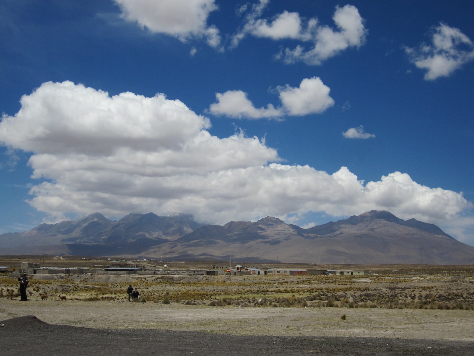
It was very cold that night, and Stuart and I gratefully pulled all three wool blankets over us when we went to sleep.  The next morning, we loaded up at 7am for the drive west on the south rim, stopping at a couple of small villages along the way.  The canyon was getting deeper and more dramatic as we headed west.  We drove on a gravel road along the rim, passing almost no other vehicles, but a few burros and sheep!  This is the only road.  The goal is to get to The Cross of the Condor, a rim overlook, before 9:30.

The giant Andean Condors live almost no where else except in this canyon and the Cotahuisi Canyon, just to the north, which is deeper than the Colca Canyon.  We learned they don't actually fly:  they soar.  With an 11 foot wing-span, they are too big to fly.  Which explains whey they live on the cliffs of the Colca Canyon.  In the morning, about 9am, the air warms enough to create drafts that the birds glide on.  They are vultures, so they feed on the dead cows, llamas and alpacas they find in the canyon.

Going to Cruz el Condor doesn't guarantee a sighting, and we were thrilled to see a condor sunning herself as we walked to the rim!  Soon, another appeared, soaring overhead.  Look!  We sat on the rim for about an hour, watching them swoop and soar, disappearing over one ridge and reappearing a few minutes later.  By the time we left the area, we had seen 12 of the giant birds.


Five of us in the van of 12 people wanted to walk a little along the rim, and our guide walked with us, telling us more about the economy and history of the area.  We learned that the three small villages at the bottom of the canyon grow lots of citrus, all of which is hauled out on the backs of the men in the village.  I heard from other backpackers that the hike to the bottom is a terrific three-day trip.  Agricultural habits have not changed much in the past several hundred years, the economy is still driven by the same engine.  The terracing the Incans began is expanding, and used all through the canyon.

As we walked along the rim, I saw another condor below us! And, look, another!  It was thrilling to see two at a time, and watch them soar and twirl on the drafts.  There is no way the pictures here show the grandness of the giant birds.   Behind them, the sky was turquoise.  It was a good day.


On the way back to Chivay, we made several stops to see Incan tombs built in the mountainside above the road; or to see talk about the extensive terracing and the importance of the crops in the canyon area.  We talked about the influence of tourism money, and the slight changes as a result.  At one stop, local women had set up booths selling crafts and food.  I bought a fruit, a fruit from a cactus that was unfamiliar to me.  It was both sweet and tart, with the texture of a kiwi.  See the picture here...

The trip to the Colca Canyon was as memorable as the trip to Machu Pichu, something I'll always remember.        
Posted by Picasa

Wednesday, January 9, 2013

Colca Canyon

The Colca Canyon is footed by the Colca River, which begins much higher up in the Andes Mountains.  The canyon is much deeper than the Grand Canyon, but doesn't have the vertical walls the Grand Canyon has.  The Must-See list Stuart and I made when planning the Peru trip included the Colca Canyon.  Confession:  I had hoped to convince Stuart to hike there, but the reality of spending 3 weeks at a high altitude made me abandon that plan!  I realized neither of us could do it.  So, we bought a bus ticket for a 2 day trip.  Chivay, pop. 5,000, is the largest town on the south rim of the canyon, and is most accessible from Arequipa, 100 miles to the southeast.   A road as we know one didn't even exist between Arequipa and Chivay until the 1950's.  Copper mining interests built the road.  One hundred miles, 3 hours, pretty good time!

 At the crest, the dry, moon-like landscape was even made even more curious by the little piles of rocks that went on as far as we could see.  The locals make these little pillars, to ask the gods for protection from evil and to bring them good luck. 
 The bus stopped at the crest between Arequipa and Chivay, and it was very cold!
Rainfall totals less than 2 inches/year in the high plains. We passed miles and hundreds of alpacas and llamas, sheep and a few vicunas.  They feed on the grass that grows only at this altitude, much like the area around Puno and Lake Titicaca's north side.  As we dropped a little bit, into the Chivay area, we began to see intensely-terraced farming.

Chivay anchors the east end of the canyon's south rim, and is the shopping hub for the canyon area, being closest to Arequipa. We arrived on a Sunday afternoon, the village was quiet.  Stuart and I hiked across the river, and up the mountainside to an Incan tower, for the views.  We watched this old woman come down from the mountain, with a load of firewood on her back, and followed the men herding the cows right through the middle of the village.

 Just before sunset, we went to the hot springs, just outside the village.  For a few soles we had a soak outside, looking up at the mountains and sky.  Beautiful!
Tourism in the Colca Canyon has increased dramatically in the past 20 years, with probably 150,000 tourist this year visiting.  We are lucky to spend the night, giving us a 2 full days in the area.  Tomorrow, we hope to see the giant Andean Condors!
Posted by Picasa

Arequipa

The backdrop for Areuqipa is dramatic and colorful.  Two, or is it three? volcanos.  argghhhhhh!  I need my notes, which are safely at home on my desk, several thousand miles from here!  Well, this blog is for me, I can read the notes later if I want.  Thank you for reading and looking!

El Misi is the larger of the two volcanos at the north side of the second largest city in Peru.  The view from the rooftop of our hostel was fabulous!  Arequipa is known as the White City, many of the colonial buildings in el centro are built from gleaming white stones.  The city was massively destroyed by earthquakes several times in the past few hundred years.  As a result, buildings are no more than 2 stories tall, with the exception of the biggest cathedral in the country.  La Catedral survived all the quakes, with damage to the bell towers only.  This is a country of superlatives!


The national taxi of Peru.

Being in the second largest city in the country means moving large numbers of people and mountains of cargo in any way possible, on streets that are terminally clogged with honking cars and smelly buses. The pedicab is the national taxi of Peru, agile, cheap and efficient. This one is used as a mobile convenience store, selling drinks (not cold!), candy and other junk food. Thankfully, there are millions of these wonderful vehicles, which neither consume gas or emit terrible fumes in the air.


 The sunset view of the back of the cathedral, taken from the rooftop of our hostel.   We enjoyed this particular view with our new friends, Salli and Jessie.  You might have read their blog, linked in my Isla Taquile post; they are on a fantastic, 2-year trip around the world.  The four of us spent a few more days in Arequipa than we'd all planned, just to have a few more days together.  They were heading south, we were heading west, after the Colca Canyon.


I


A delicious, typical Arequipa meal.  Potatoes, cooked in layers with cheese and cream, similar to a dish you might find the US.  And, a chicken dish (sure could use my notes about right HERE!).
In the days before we arrived in Arequipa, people would roll their eyes toward the heavens when Arequipa food was mentioned.  It was as good as it's reputation!


I had to photograph this cake, in a bakery we passed one day, even though it's not a very good photo.  The cakes are just spectacular!  Grand, elaborate, colorful, sculptural.  I wonder if they are tasty?


Even the flowers here are grand.  These xxx were as tall as me!  The parks were filled with them, in many glorious colors.


One of the jewels of the city is the Santa Catalina Monastery.  Not only is the architechture beautiful, the history of the site is fascinating.   We took a sunset tour of the former convent, joining Salli and Jessie.  It was built in 1579, by a rich woman, Maria Guzman.  At the time, the tradition was for the second daughter to enter the monastery, but her parents had to be wealthy enough to financially support her and the servants she needed.  It was a small city within the city, with a population of as many as 450 people!

About 1870,  the Church leaders in Europe began to be not-quite-pleased with the arrangement there, and ordered big changes:  no more servants was the most difficult change.  There was no electricity, and while there was plumbing, as late as the 1950's the plumbing was the original system built in the 16th century!  Today, there are about 20 nuns living in a modern adjascent to the old complex.  The complex is well-maintained, and open for tours now.


A street in the city, just before sunset.  Each of the doors entered the private 'house' of a nun, with space for cooking and servants.  Each of the  nuns took in a small child from Arequipa, to teach them to read.  When the child was about 15, she had the choice of staying on and becoming a nun, or returning to public life.  This was the only way girls were educated at the time.


A clock. The water from the cone-shaped porous clay dripped into the bowl below, marking a known amount of time.


The kitchen!  The centuries-old soot was still there, in spite of the clean up for tourists...the flash on my camera lies about the darkness of the place.  The only light was from the vent in the ceiling.  I believe the clay bowls were original.


The laundry.  Water came from a spring at the top of the photo, came down the channel and was diverted into the giant clay bowls, the wash tubs.  The bowls are halves of the giant jugs used in the local wine industry.  In the bottom of the tubs was plugged with a piece of cloth, and when the water was released, it was drained into the gardens below the laundry area.


Stuart, in the laundry!

Afterwards, we enjoyed dinner together above the plaza, with Pisco Sours and good company.


Posted by Picasa

More pictures from Isla Taquile

  I thought this post would be about adventures further along the road, but realized a few pictures from Isla Taquile were begging to be posted.

The trip to Taquile made a big impression on us:  the beauty of the island, the beauty of the people, the remoteness, the preservation of their culture while adopting modern concepts.  There is no electricity on the island, but a few people had generators, run with gas that is hauled from Puno in 5 gallon containers.  So, with those generators tv is possible.  We saw a few antenaes in mounted on the rooftop of the tiny stone houses.

The terrain is rough and steep.  In addition to being more than 2 miles above sea level, the island rises even higher, causing us to stop often when we hiked to the ridge for a sunset veiw.  The Incan terracing is used, and more terracing has been added over the centuries.


Some of the stone fences are used to keep the sheep in....or out!  Tiny fields of corn, beans or potatoes were behind every fence that didn't contain livestock.  It's very arid here, water at the highers elevations is scarce.


I found this building at the peak of the north end of the island.  The thatched roof was gone, but it looked like it had been lived in recently.  In it's old age, it was a beautifully built structure that had apparently survived earthquakes.


Living in a remote place requires ingenuity.  I loved the hinges on the fences! Use what you have, make what you have work:  shoe soles, nailed into the post and gate work great!


The single-row plow.  An ancient invention, made available at a cheap price in the US by John Deere Company.  Here, the tractor doesn't exist, an ox or two pull the single plow, tied to a tree trunk with leather strapping.  It took two to plow the rocky terraces:  one to lead the ox, the other to hold the plow.  It's a rich family that can afford such equipment.


Sheep moving south on the 101.  Children and old people are the sheep tenders, the younger people work in the fields.  Both men and women are doing something with their hands most of the time; the women are spinning yarn or knitting, the men are knitting.  Even while they are walking!


Posted by Picasa

Monday, January 7, 2013

Isla Taquile pictures

  The boat to Isla Taquile, Taquile Island, went out from Puno through the grasslands of Lake Titicaca, to Isla Uros, Uros Islands.  Uros is a group of floating islands, built on an accumulation of grasses piled layer on layer.  The people of Uros have lived like this for several centuries, close to Puno.  In the past years, the people and their way of life have become a tourist curiosity, and even though I've never been there, I could see the changes the locals had made to entertain the tourists.  Our stop there was about an hour, and we had watched a prepared presentation to explain how the islands are built, and how the people live.  It was truly facsinating!  Every step we took was like walking in one of those kids games at the state fair, the moon walk.  Squishy, but dry.  The people  rely on tourists buying their handicrafts for their livelihood.  There is a small conversation in Puno about the Uros people not living on their islands now, but living in the city, a rumor that has negative energy.  They have a reputation of not marrying non-Uros people, but I have to wonder how much longer that will last.
We motored on to Taquile, another 3 hours of beautiful blue sky and water, and views of dry desert land as we pass out of the Puno Bay and into the open lake.  The trip is pretty smooth, until we reach the island, when the wind has picked up, and we are tossed.  The boats unload on the north side of the island, and depart from the southside.  We wonder why....more later on that!

Stuart and I planned to spend the night on Taquile.  Andy, who we met on our boat, is also spending the night.  The three of us have our full backpacks.  Later, I wonder why I didn't think of leaving most of our stuff in Puno, and hauling just a day pack.  Duh. The hike from the boat landing to the tiny village on Taquile took us an hour, and we kept up with the day-trippers, who had no packs.  All this at more than 2 miles above sea level.  We felt like the hike was at a 30% grade, too.  Thank goodness for being in good physical shape.  The views were spectacular!  Oh, my!  The tourist tax we all paid with our boat ticket, paid for the 'highway' that runs from the north to the south of the island, about 5 miles.  The highway, which Andy called the 101, was a paved sidewalk, about 2 people wide.


 Yes, the color really is as intense as this photo!


We arrived on Taquile Sunday afternoon.  The tiny square, at the top of the island, was filled with  the islanders, all dressed in their best clothes.  We later learned we had arrived on the annual meeting day. This is the day when the locals meet to vote on the new island council, who in turn decide how to divide the income from the cooperative  The cooperative hosts tourists for overnight stays on the island.  The families in the coop rotate the duties of housing and feeding the tourists. The villagers were very solemn, there was total silence while some of the ceremony of passing the coco leaves was conducted.  Stuart, Andy and I were the only non-villagers there, and while we stood as far away as possible in the plaza, we felt conspicuous.

 There is no electricity or running water on the island, there are no vehicles.  If it's eaten, it's grown on terraces begun by the Incans in the 15th century.  Fish is the other diet staple, of course.  If it's moved from boat to the village, it's hauled up that steep path, on someone's back.  I can not begin to describe the life there.   Better to read the post written by our friends Jessie and Sally, who we met later in the trip.  Their blog post is exquisitely presented.  Here is the link:


  http://www.jsoutofbounds.blogspot.mx/

The rest of this post includes pictures I took.          
Posted by Picasa