
Next morning, we drove east, to the Canso Causeway, linking lower NS to Cape Breton Islands. The deepest man-made causeway in the world. Eight hundred feet wide at the botton, 300 feet deep. We headed north on the west coast road, NS 19, to Judique, where we stopped for lunch at the levelest part of the island. The Little Judique Train ran through here in the early 1900's, making up for lost time on the hilly, curvy sections north of here. Being on the Island feels different, and there is not really any good reason except that the views are dramatic and the pace is slower. The pace is something we can't possibly know about, having just arrived, but we could feel it. Not having a reservation, arriving on a weekend, we were danged lucky to get a spot at MacLeod's Campground and Beach.

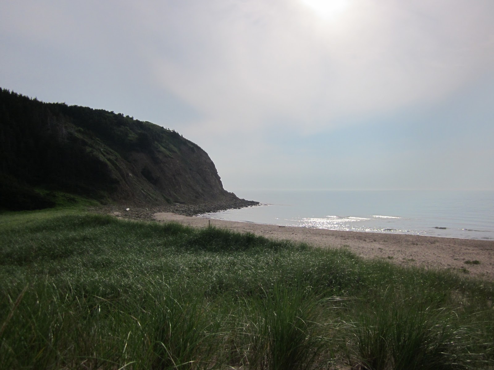
As we turned off the terribly-paved road onto a gravel road, we wondered what we were getting into...but, as we turned off the gravel road into the cg, and saw the freshly-cut hay field and the cg overlooking the Northumberland Strait. This photo was taken from a few steps from our campsite, at sunset. The small sandy beach was tucked in between rock cliffs, with lots of small colorful rocks for collecting. We stayed here several days, and toured the Cabot Trail from here.

Northern Cape Breton Island is mostly set aside as National Park, and what a jewel for NS! Beautiful vistas around every turn of the road. The Scottish settled here, in large numbers, between 1790 and 1830. After the French were conquered by England and New England. The road signs are all in English and Gaelic, and the names on roads are all Scottish-sounding. Fishing, and a little farming, are the main livelihoods.


Sunday morning, while it was still cool, I pedaled the loop road, from our cg, around the cove and up the coast, back to the paved road, then back onto the gravel loop road. The wild roses were everywhere! Nice ride, uphill the whole time. Not.
Sunday afternoon, we drove back up to Cheticamp, about 45 minutes north, and jumped on the Whale Cruiser for a couple of hours. Our host, who had been out that morning, told us it was one of the best tours he'd been on in several years. They saw LOTS of pilot whales. Well, just a few minutes after we pulled away from the dock, he was even happier: We saw several dozen whales, and they played and swam around our boat for over an hour!


MacCleod's Beach and CG was one of the pretties places we stayed...I hated to leave, but, we're heading now to the eastern part of the Island, to historic Fortress Louisbourg.
1 comment:
Gorgeous images!
Post a Comment