

This is a lighthouse of a different sort: The Three Sisters, in downtown St. John, guided captains safely into harbor only if they could see all three lights. If the captain could only see two of the lights, he knew to correct course. The lights are not used any more, this is a replica, and they were repositioned to make better placement in the downtown plaza.

The St. John River channels the equivalent of water of all the rivers in the world in one tide! Yep, that's true. We stood above the river about halfway between low and high tide (going out), to watch what the locals call The Reversing Falls. The force of the outgoing river meets the force of the incoming Bay of Fundy tide, and the result is far more entertaining than anything at the movie theaters. As usual, this photo doesn't begin to convey the power.


All that tidal rush and lighthouse search made us thirsty, so we found some local brews, in the one hour of sunshine that appeared.

After a few days of city life, we moved north to St. Martins. The freeway from the border to NS is a dream highway: smooth, pretty level even on this rocky coast, and limited access. The secondary roads are mostly totally opposite: dreadful surfaces old, failed patches and axle-breaking potholes, 15% grades complete with sharp curves, and unpredictably intersected with unmarked crossroads. Our underpowered truck worked hard to get to the top of some of those 15% grades, and we were grateful for adjustable
trailer brakes on the downhill part of those grades. The countryside is equally picturesque, making it all OK.
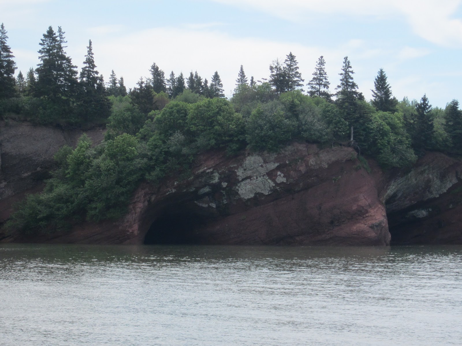
St. Martins was an enormously important ship building community, today about an hour's drive from St. John, the big port. At the time of ship building, there was no road. We landed in Century Farms CG early Friday afternoon, and our host directed us to a pretty grassy spot RIGHT ON THE BAY! This is the kind of treatment the big rigs usually get, and he guided our tiny cottage right up front and center. We had a quick lunch, with a stunning view of the Bay of Fundy, and headed across the tiny cove to the sea caves, which we could see from our site. The tide was heading out, our chance to get to the sea caves.

sea caves, St. Martin, high tide. Wow.

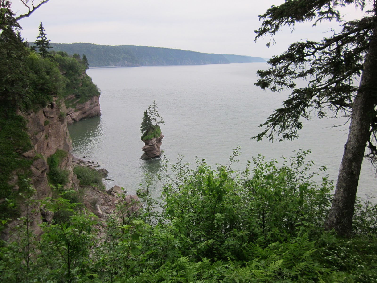
The next day, we loaded our bikes and a picnic lunch, and drove a few miles to the top of the sea cave bluffs, to the beginning of the Fundy Trail. It's about 12 miles of Parkway-like road along the cliffs with the most awesome views of the BofF. At the second parking area (there are about 18 places to pull over, in order to not hurt yourself while gazing at the view), we unloaded the bikes and our picnic, and started along the gravel bike trail that more-or-less parallels the road. Pretty soon, we figured out that as newcomers, we would do much better either walking or driving, since we were stopped every few feet to look at something. We left the bikes at the next parking area, and climbed down the bluff to Melvin's Beach to find the high tide filled in the marsh, blocking access to the beach. Halfway back to the top, we found another trail, leading to Flowerpot Rock, and took that trail. What views!
 Abandoned bikes, with Melvin's Beach in the background. We had no fear of them being stolen. Anyone visiting this remote place is here for the awesome geography, not antique bicycles!
Flower Pot Rock, high tide. More later, the rain has stopped for a few minutes, think I'll go for a walk!
No comments:
Post a Comment